|
search place name
|
||
Pintueles (Asturias, Spain)Pintueles is a town in the Asturias region of Spain. An overview map of the region around Pintueles is displayed below.
regional and 3d topo map of Pintueles, Spain ::

Pintueles airports ::
The nearest airport is OVD - Aviles Asturias, located 59.6 km west of Pintueles.
Other airports nearby include SDR - Santander (124.1 km east), VLL - Valladolid (188.9 km south), BGC - Braganca (201.2 km south west), Nearby towns ::
Argandenes (1.3km east) //
Lodeña (2.3km north west) //
Cadanes (2.3km north east) //
Infiesto (2.3km south west) //
Piloña (2.3km south west) //
Villanueva (2.3km south west) //
La Busta (2.7km east) //
Valles (2.7km east) //
Monte Coya (2.7km west) //
Berbio (3.7km south) //
Moñío (3.3km north east) //
Borines (3.3km north east) //
Bargaedo (3.3km north west) //
Viyao (3.9km north) //
Robledo (3.9km north) //
Cotariella (3.9km north) //
Anayo (3.9km north) //
Melarde (3.3km south east) //
San Román (3.3km south east) //
Ques (3.3km south west) //
Estelí (3.9km south) //
Valle (3.9km south) //
Santianes (3.9km south) //
Cardes (3.9km south) //
Sieres (4.6km north east) //
La Infiesta (4.6km north east) //
Cervera (4.6km north west) //
Beloncio (4.6km south west) //
Llares (5.6km north) //
[all distances 'as the bird flies' and approximate] 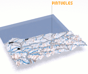 Places with similar names to Pintueles, Spain ::
// Ponte a Elsa (IT)
// Puntalazzo (IT)
// Pandėlys (LT)
// Pantelići (BA)
// Pantelići (BA)
// Pantelići (BA)
// Pantelići (BA)
// Pendueles (ES)
// Pontellas (ES)
// Pontellas (ES)
Disclaimer :: Information on this page comes without warranty of any kind |
||
|
Where is Pintueles? Elevation and coordinates ::
Latitude (lat): 43°22'0"N Longitude (lon): 5°21'0"W
Elevation (approx.): 448m (map arrows pan, magnifying glasses zoom) |
||
|
Visiting Pintueles? Hotel/Accommodation ::
Book a hotel in Pintueles Travel Guide ::
Buy a travel guide for Spain rental cars ::
car rental offers GPS waypoint ::
download a GPX waypoint (PoI) of Pintueles for your GPS receiver
|
||