|
search place name
|
||
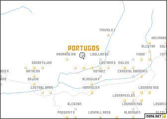
Pórtugos (Andalucía, Spain)Pórtugos is a town in the Andalucía region of Spain. An overview map of the region around Pórtugos is displayed below.
regional and 3d topo map of Pórtugos, Spain ::
Pórtugos airports ::
The nearest airport is GRX - Granada Armilla, located 34.9 km north west of Pórtugos.
Other airports nearby include GRX - Granada (48.8 km north west), LEI - Almeria (85.2 km east), AGP - Malaga (109.8 km west), ODB - Cordoba (167.9 km north west), Nearby towns ::
Ferreirola (1.9km south) //
Pitres (2.4km south west) //
Mecina Fondales (2.4km south west) //
Atalbéitar (2.4km south east) //
Busquístar (2.4km south east) //
Bubión (3.0km west) //
Pampaneira (3.0km west) //
Los Llanos (3.0km east) //
Capileira (3.5km north west) //
Venta del Relleno (3.5km south east) //
Notáez (4.7km south east) //
Las Fuentezuelas (4.8km north east) //
Cástaras (4.8km south east) //
Almegíjar (5.8km south) //
Torviscón (7.6km south) //
Trevélez (7.1km north east) //
Los Agustines (9.5km south west) //
[all distances 'as the bird flies' and approximate] 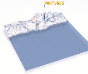 Places with similar names to Pórtugos, Spain ::
// Perdições (BR)
// Pôrto Góis (BR)
// Portuguêsa (BR)
// Paradox (US)
// Pradix (FR)
// Pradaccio (IT)
// Pradaccio (IT)
// Prataccio (IT)
// Paradox (US)
// Perdix (US)
Disclaimer :: Information on this page comes without warranty of any kind |
||
|
Where is Pórtugos? Elevation and coordinates ::
Latitude (lat): 36°57'0"N Longitude (lon): 3°19'0"W
Elevation (approx.): 1526m (map arrows pan, magnifying glasses zoom) |
||
|
Visiting Pórtugos? Hotel/Accommodation ::
Book a hotel in Pórtugos Travel Guide ::
Buy a travel guide for Spain rental cars ::
car rental offers GPS waypoint ::
download a GPX waypoint (PoI) of Pórtugos for your GPS receiver
|
||