|
search place name
|
||
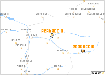
Pradaccio (Italy)Pradaccio is a town in Italy. An overview map of the region around Pradaccio is displayed below.
regional and 3d topo map of Pradaccio, Italy ::
Pradaccio airports ::
The nearest airport is SMV - Samedan, located 42.8 km west of Pradaccio.
Other airports nearby include BZO - Bolzano (68.6 km east), BGY - Bergamo Orio Al Serio (104.6 km south west), INN - Innsbruck (112.3 km north east), VBS - Montichiari (115.6 km south), Nearby towns ::
Baite del Zebrù (1.3km east) //
SantʼAntonio (2.3km south west) //
Scalogna (6.1km south east) //
Bormio (5.1km west) //
Valfurva (5.1km west) //
Santa Caterina Valfurva (6.8km south east) //
San Raineri (7.8km north) //
Grandʼ Albergo (9.0km north east) //
[all distances 'as the bird flies' and approximate]  Places with similar names to Pradaccio, Italy ::
// Perdições (BR)
// Pôrto Góis (BR)
// Portuguêsa (BR)
// Paradox (US)
// Pradix (FR)
// Pradaccio (IT)
// Prataccio (IT)
// Pórtugos (ES)
// Paradox (US)
// Perdix (US)
Disclaimer :: Information on this page comes without warranty of any kind |
||
|
Where is Pradaccio? Elevation and coordinates ::
Latitude (lat): 46°28'0"N Longitude (lon): 10°26'0"E
Elevation (approx.): 1651m (map arrows pan, magnifying glasses zoom) |
||
|
Visiting Pradaccio? Hotel/Accommodation ::
Book a hotel in Pradaccio Travel Guide ::
Buy a travel guide for Italy rental cars ::
car rental offers GPS waypoint ::
download a GPX waypoint (PoI) of Pradaccio for your GPS receiver
|
||