|
search place name
|
||
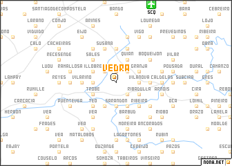
Vedra (Galicia, Spain)Vedra is a town in the Galicia region of Spain. An overview map of the region around Vedra is displayed below.
regional and 3d topo map of Vedra, Spain ::
Vedra airports ::
The nearest airport is SCQ - Santiago, located 13.2 km north of Vedra.
Other airports nearby include LCG - La Coruna A Coruna (58.1 km north), VGO - Vigo (62.7 km south), OPO - Porto (171.5 km south), BGC - Braganca (177.8 km south east), Nearby towns ::
Lestedo (1.9km north) //
Sales (2.3km north west) //
Merín (2.3km south east) //
Pazos (2.3km north east) //
Vaamonde (2.7km west) //
Sarandón (3.7km south) //
Vilanova (2.7km east) //
Trobe (3.3km south west) //
Santeles (3.9km south) //
Illobre (3.3km north west) //
Sarandón (3.9km south) //
Paradela (3.9km south) //
Ribadulla (3.3km south east) //
Quian (3.9km north) //
Granja (3.3km north east) //
Teo (4.6km south west) //
Sales (4.6km north west) //
Ribeira (4.6km south east) //
Sergude (5.6km north) //
Ribadulla (4.1km east) //
Vilariño (4.1km west) //
Susana (5.7km north) //
Rodiño-Pequeño (5.7km north) //
Barbud (5.7km south) //
Marrozos (6.2km north west) //
Berres (5.5km south east) //
Vea (6.2km south west) //
Boqueijón (5.5km north east) //
Oza (5.4km west) //
[all distances 'as the bird flies' and approximate]  Places with similar names to Vedra, Spain ::
Disclaimer :: Information on this page comes without warranty of any kind |
||
|
Where is Vedra? Elevation and coordinates ::
Latitude (lat): 42°47'0"N Longitude (lon): 8°28'0"W
Elevation (approx.): 237m (map arrows pan, magnifying glasses zoom) |
||
|
Visiting Vedra? Hotel/Accommodation ::
Book a hotel in Vedra Travel Guide ::
Buy a travel guide for Spain rental cars ::
car rental offers GPS waypoint ::
download a GPX waypoint (PoI) of Vedra for your GPS receiver
|
||