|
search place name
|
||
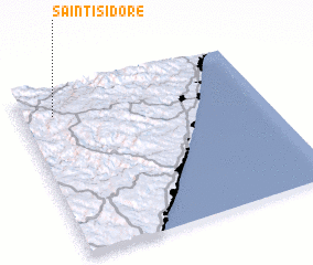
Saint Isidore (KwaZulu-Natal, South Africa)Saint Isidore is a town in the KwaZulu-Natal region of South Africa. An overview map of the region around Saint Isidore is displayed below.
regional and 3d topo map of Saint Isidore, South Africa ::

Saint Isidore airports ::
The nearest airport is PZB - Pietermaritzburg, located 61.2 km north east of Saint Isidore.
Other airports nearby include MGH - Margate (81.0 km south), DUR - Durban Intl (81.3 km east), VIR - Durban Virginia (98.7 km north east), LAY - Ladysmith (177.8 km north), Nearby towns ::
 Places with similar names to Saint Isidore, South Africa ::
// Santo Esidro (BR)
// Santo Isidoro (BR)
// Santo Isidro (BR)
// San Desiderio (IT)
// Santo Izidoro (PT)
// Santo Izidro (PT)
// Saint-Isidore (ML)
// Saint-Satur (FR)
// SantʼIsidoro (IT)
// Saint-Astier (FR)
Disclaimer :: Information on this page comes without warranty of any kind |
||
|
Where is Saint Isidore? Elevation and coordinates ::
Latitude (lat): 30°9'0"S Longitude (lon): 30°8'0"E
Elevation (approx.): 914m (map arrows pan, magnifying glasses zoom) |
||
|
Visiting Saint Isidore? Hotel/Accommodation ::
Book a hotel in Saint Isidore Travel Guide ::
rental cars ::
car rental offers GPS waypoint ::
download a GPX waypoint (PoI) of Saint Isidore for your GPS receiver
|
||