|
search place name
|
||
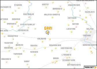
Gari (Tverskaya Oblast', Russia)Gari is a town in the Tverskaya Oblast' region of Russia. An overview map of the region around Gari is displayed below.
regional and 3d topo map of Gari, Russia ::
Gari airports ::
The nearest airport is KLD - Tver Migalovo, located 61.7 km south east of Gari.
Nearby towns ::
Dobryni (1.8km south) //
Kolodino (3.0km south west) //
Kocherovo (5.3km south) //
Yeskino (3.6km north west) //
Medvedkovo (5.5km south) //
Skripkovo (6.2km south) //
Maloye Vishen'ye (6.7km north) //
Novinki (6.1km south west) //
Pyatnitsa-Plot (5.0km north west) //
Churikovo (5.6km north east) //
Lazutino (4.9km east) //
Isakovo (8.4km south) //
Baranovo (9.1km north) //
Kosteshino (7.5km south east) //
Pudyshevo (7.9km north west) //
Golovinskiye Gorki (9.9km south east) //
[all distances 'as the bird flies' and approximate]  Places with similar names to Gari, Russia ::
Disclaimer :: Information on this page comes without warranty of any kind |
||
|
Where is Gari? Elevation and coordinates ::
Latitude (lat): 57°3'24"N Longitude (lon): 34°50'13"E
Elevation (approx.): 207m (map arrows pan, magnifying glasses zoom) |
||
|
Visiting Gari? Hotel/Accommodation ::
Book a hotel in Gari Travel Guide ::
Buy a travel guide for Russia rental cars ::
car rental offers GPS waypoint ::
download a GPX waypoint (PoI) of Gari for your GPS receiver
|
||