|
search place name
|
||
Kalinin (Rostovskaya Oblast', Russia)Kalinin is a town in the Rostovskaya Oblast' region of Russia. An overview map of the region around Kalinin is displayed below.
regional and 3d topo map of Kalinin, Russia ::
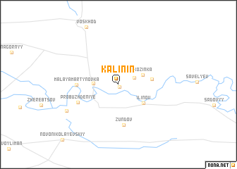
Nearby towns ::
Yegorov (0.4km south) //
Tavrichanskiy (2.0km north east) //
Yuzhnyy (2.7km west) //
Kozinka (3.0km north east) //
Il'inov (4.0km south east) //
Frolov (3.7km east) //
Zundov (6.4km south) //
Malaya Martynovka (4.5km west) //
Probuzhdeniye (5.2km south west) //
Rodionov (7.0km south west) //
Novonikolayevskiy (10.6km south west) //
[all distances 'as the bird flies' and approximate] 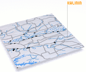 Places with similar names to Kalinin, Russia ::
// Kalinino (AZ)
// Calaanan (PH)
// Calaanan (PH)
// Calañan (PH)
// Calanan (PH)
// Calanian (PH)
// Calao-anan (PH)
// Calauan-on (PH)
// Calinauan (PH)
// Colinauan (PH)
Disclaimer :: Information on this page comes without warranty of any kind |
||
|
Where is Kalinin? Elevation and coordinates ::
Latitude (lat): 47°20'12"N Longitude (lon): 41°53'54"E
Elevation (approx.): 27m (map arrows pan, magnifying glasses zoom) |
||
|
Visiting Kalinin? Hotel/Accommodation ::
Book a hotel in Kalinin Travel Guide ::
Buy a travel guide for Russia rental cars ::
car rental offers GPS waypoint ::
download a GPX waypoint (PoI) of Kalinin for your GPS receiver
|
||