|
search place name
|
||
Mollakent (Dagestan, Russia)Mollakent is a town in the Dagestan region of Russia. An overview map of the region around Mollakent is displayed below.
regional and 3d topo map of Mollakent, Russia ::

Mollakent airports ::
The nearest airport is MCX - Makhachkala Uytash, located 116.2 km north west of Mollakent.
Other airports nearby include BAK - Baku Heydar Aliyev (213.4 km south east), Nearby towns ::
Arablyar (1.3km north) //
Aglobi (3.4km south west) //
Belidzhi (3.9km south east) //
Belidzhi (5.2km south) //
Arablinskoye (6.8km north west) //
Rubas (6.3km south west) //
Mollakhalil (7.1km south east) //
Nyugdi (7.7km south east) //
Khazar (8.9km north west) //
Kommuna (7.8km south west) //
Nizhniy Dzhalgan (8.9km north west) //
Selik (9.3km south east) //
[all distances 'as the bird flies' and approximate] 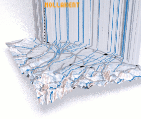 Places with similar names to Mollakent, Russia ::
// Mǝlikkǝnd (AZ)
// Mollakǝnd (AZ)
// Mollakǝnd (AZ)
// Malagnat (PH)
// Malagonot (PH)
// Milkantai (LT)
// Mollakendi (TR)
// Mallakent (RU)
// Mailākānda (BD)
// Mālikānda (BD)
Disclaimer :: Information on this page comes without warranty of any kind |
||
|
Where is Mollakent? Elevation and coordinates ::
Latitude (lat): 41°55'24"N Longitude (lon): 48°23'11"E
Elevation (approx.): -15m (map arrows pan, magnifying glasses zoom) |
||
|
Visiting Mollakent? Hotel/Accommodation ::
Book a hotel in Mollakent Travel Guide ::
Buy a travel guide for Russia rental cars ::
car rental offers GPS waypoint ::
download a GPX waypoint (PoI) of Mollakent for your GPS receiver
|
||