|
search place name
|
||
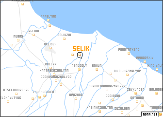
Selik (Dagestan, Russia)Selik is a town in the Dagestan region of Russia. An overview map of the region around Selik is displayed below.
regional and 3d topo map of Selik, Russia ::
Selik airports ::
The nearest airport is MCX - Makhachkala Uytash, located 125.4 km north west of Selik.
Other airports nearby include BAK - Baku Heydar Aliyev (204.2 km south east), Nearby towns ::
Nyugdi (1.8km north west) //
Mollakhalil (2.3km north) //
Azadogly (2.5km south) //
Samur (3.6km south east) //
Belidzhi (5.4km north west) //
Kartaskazmalyar (6.0km south west) //
Kullar (5.7km west) //
Belidzhi (5.8km north west) //
Tagirkent-Kazmalyar (6.1km south east) //
Yarukvalar (6.9km south west) //
Darkushkazmalyar (6.7km south west) //
Khtunkazmalyar (7.6km south east) //
Chakhchakhkazmalyar (8.4km south east) //
Mollakent (9.3km north west) //
Arablyar (10.5km north west) //
Chukhverkent (10.7km south west) //
[all distances 'as the bird flies' and approximate] 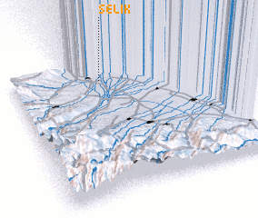 Places with similar names to Selik, Russia ::
Disclaimer :: Information on this page comes without warranty of any kind |
||
|
Where is Selik? Elevation and coordinates ::
Latitude (lat): 41°51'21"N Longitude (lon): 48°27'7"E
Elevation (approx.): 18m (map arrows pan, magnifying glasses zoom) |
||
|
Visiting Selik? Hotel/Accommodation ::
Book a hotel in Selik Travel Guide ::
Buy a travel guide for Russia rental cars ::
car rental offers GPS waypoint ::
download a GPX waypoint (PoI) of Selik for your GPS receiver
|
||