|
search place name
|
||
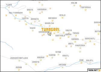
Tumagari (Dagestan, Russia)Tumagari is a town in the Dagestan region of Russia. An overview map of the region around Tumagari is displayed below.
regional and 3d topo map of Tumagari, Russia ::
Tumagari airports ::
The nearest airport is MCX - Makhachkala Uytash, located 89.7 km east of Tumagari.
Nearby towns ::
Matlas (1.6km north) //
Gozolokolo (1.5km south east) //
Khimakoro (1.5km north east) //
Khimakoro (1.9km west) //
Shotota (2.3km west) //
Akhalchi (2.5km north east) //
Gortkolo (2.7km east) //
Akhalchi (3.8km north) //
Verkhniye Akhalchi (3.2km north east) //
Gatsalukh (3.8km east) //
Tsalkita (4.9km north west) //
Mochokh (5.7km north) //
Oboda (4.9km east) //
Ebuta (5.1km east) //
Chondotl' (5.7km south east) //
Siukh (5.3km north west) //
Dzhalaturi (6.4km north west) //
Nitab (7.2km south) //
Andykh (7.5km south) //
Kuanib (8.0km south) //
Amishta (6.9km north west) //
Ochlo (7.6km north east) //
Baitl' (6.7km south east) //
Tsel'mes (7.1km north west) //
Kolo (9.0km north) //
Nakitl' (9.2km south east) //
Orota (10.5km north west) //
[all distances 'as the bird flies' and approximate] 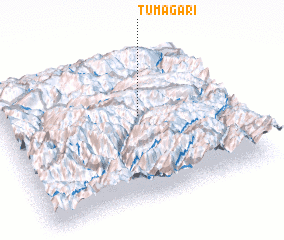 Places with similar names to Tumagari, Russia ::
// Tomaicuri (BO)
// Demakar (IQ)
// Timmukuru (EE)
// Dāmgāra (BD)
// Dāmgāra (BD)
// Dāmgāria (BD)
// Demākuri (BD)
// Tammboukirou (BJ)
// Diémoukourou (BF)
// Doumoukora (BF)
Disclaimer :: Information on this page comes without warranty of any kind |
||
|
Where is Tumagari? Elevation and coordinates ::
Latitude (lat): 42°34'44"N Longitude (lon): 46°36'21"E
Elevation (approx.): 1887m (map arrows pan, magnifying glasses zoom) |
||
|
Visiting Tumagari? Hotel/Accommodation ::
Book a hotel in Tumagari Travel Guide ::
Buy a travel guide for Russia rental cars ::
car rental offers GPS waypoint ::
download a GPX waypoint (PoI) of Tumagari for your GPS receiver
|
||