|
search place name
|
||
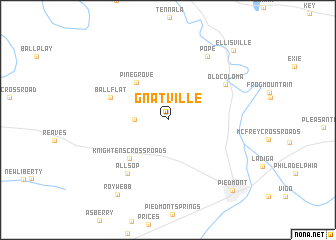
Gnatville (Alabama, United States - USA)Gnatville is a town in the Alabama region of United States - USA. An overview map of the region around Gnatville is displayed below.
regional and 3d topo map of Gnatville, United States - USA ::
Gnatville airports ::
The nearest airport is ANB - Anniston Metro, located 48.2 km south of Gnatville.
Other airports nearby include MGE - Marietta Dobbins Arb (Atlanta Nas) (107.6 km east), BHM - Birmingham Intl (110.7 km south west), HUA - Redstone Aaf (119.8 km north west), ATL - Hartsfield Jackson Atlanta Intl (122.2 km east), Nearby towns ::
Estes Crossroads (3.1km west) //
Pine Grove (5.1km north west) //
Knightens Crossroads (5.6km south west) //
Ball Flat (5.9km north west) //
Allsop (7.1km south west) //
Old Coloma (6.6km north east) //
Pope (7.9km north east) //
Roy Webb (9.6km south west) //
Ellisville (9.8km north east) //
Piedmont (9.9km south east) //
[all distances 'as the bird flies' and approximate]  Places with similar names to Gnatville, United States - USA ::
// Naidooville (ZA)
// Ndofela (ZA)
// Knottville (US)
// Needfull (US)
// Needful (US)
// Needville (US)
// Naitauvoli (FJ)
// Naudville (CA)
Disclaimer :: Information on this page comes without warranty of any kind |
||
|
Where is Gnatville? Elevation and coordinates ::
Latitude (lat): 33°59'43"N Longitude (lon): 85°40'34"W
Elevation (approx.): 209m (map arrows pan, magnifying glasses zoom) |
||
|
Visiting Gnatville? Hotel/Accommodation ::
Book a hotel in Gnatville Travel Guide ::
rental cars ::
car rental offers GPS waypoint ::
download a GPX waypoint (PoI) of Gnatville for your GPS receiver
|
||