|
search place name
|
||
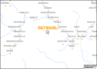
Naitauvoli (Fiji)Naitauvoli is a town in Fiji. An overview map of the region around Naitauvoli is displayed below.
regional and 3d topo map of Naitauvoli, Fiji ::
Naitauvoli airports ::
The nearest airport is SUV - Nausori Intl, located 44.1 km south east of Naitauvoli.
Other airports nearby include NAN - Nandi Nadi Intl (82.3 km west), LMG - Lambasa Labasa (191.3 km north east), Nearby towns ::
Nuku (2.6km north west) //
Nawala (5.1km north east) //
Waimbalavu (5.8km north) //
Saumakia (5.6km east) //
Navuniyasi (5.6km east) //
Korosuli (6.6km north east) //
Naivuthini (6.5km south east) //
Nairukuruku (7.1km east) //
Ndraunindakua (7.4km north) //
Vunindumba (7.3km east) //
Nasalia (7.7km north west) //
[all distances 'as the bird flies' and approximate] 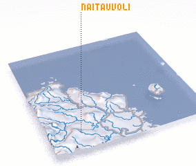 Places with similar names to Naitauvoli, Fiji ::
// Gnatville (US)
// Naidooville (ZA)
// Ndofela (ZA)
// Knottville (US)
// Needfull (US)
// Needful (US)
// Needville (US)
// Naudville (CA)
Disclaimer :: Information on this page comes without warranty of any kind |
||
|
Where is Naitauvoli? Elevation and coordinates ::
Latitude (lat): 17°49'0"S Longitude (lon): 178°13'0"E
Elevation (approx.): 106m (map arrows pan, magnifying glasses zoom) |
||
|
Visiting Naitauvoli? Hotel/Accommodation ::
Book a hotel in Naitauvoli Travel Guide ::
Buy a travel guide for Fiji rental cars ::
car rental offers GPS waypoint ::
download a GPX waypoint (PoI) of Naitauvoli for your GPS receiver
|
||