|
search place name
|
||
Cedar Ridge (California, United States - USA)Cedar Ridge is a town in the California region of United States - USA. An overview map of the region around Cedar Ridge is displayed below.
regional and 3d topo map of Cedar Ridge, United States - USA ::

Cedar Ridge airports ::
The nearest airport is MOD - Modesto City Co Harry Sham, located 77.2 km south west of Cedar Ridge.
Other airports nearby include MER - Merced Castle (80.3 km south), RIU - Rancho Murieta (86.1 km north west), SCK - Stockton Metropolitan (86.7 km west), SAC - Sacramento Executive (117.5 km north west), Nearby towns ::
Comstock Ranch (2.2km south east) //
Brentwood Park (3.5km south east) //
Crystal Falls (5.1km south) //
Goldmont Forest (5.2km south east) //
Twain Harte Valley (4.4km east) //
Lynnwood Estates (4.5km south east) //
Belleview Acres (5.6km south) //
Bellwood Estates (5.5km south west) //
Twain Harte (4.8km south east) //
Scenic Heights (5.7km south) //
Cedar Rock Lodge (5.6km south east) //
Hess Mill (5.3km north east) //
Belleview (6.0km south) //
Lilac Terrace (5.4km south east) //
Sonora Meadows (6.1km south) //
White Oak Estates (6.2km south) //
Black Oak Estates (5.4km south east) //
Jupiter (6.3km north) //
Lakewood Highlands (5.2km east) //
Cedar Pines Vista (5.7km south east) //
Sherwood Forest (6.1km south east) //
Lakewood Park (5.8km east) //
Chaparral Heights (7.4km south) //
Willow Springs (8.0km south) //
Camp Earnest (7.4km south east) //
Apple Valley Estates (7.6km south west) //
Sugarpine (6.6km east) //
Confidence (6.9km east) //
Sunshine Camp (8.7km south) //
[all distances 'as the bird flies' and approximate] 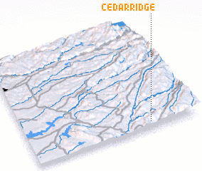 Places with similar names to Cedar Ridge, United States - USA ::
// Strugi (RU)
// Strugi (RU)
// Cedar Ridge (US)
// Cedar Ridge (US)
// Cedaredge (US)
// Cedar Ridge (US)
// Cedar Ridge (US)
// Store Eige (NO)
// Strugi (PL)
// Strugi (PL)
Disclaimer :: Information on this page comes without warranty of any kind |
||
|
Where is Cedar Ridge? Elevation and coordinates ::
Latitude (lat): 38°3'57"N Longitude (lon): 120°16'33"W
Elevation (approx.): 1148m (map arrows pan, magnifying glasses zoom) |
||
|
Visiting Cedar Ridge? Hotel/Accommodation ::
Book a hotel in Cedar Ridge Travel Guide ::
rental cars ::
car rental offers GPS waypoint ::
download a GPX waypoint (PoI) of Cedar Ridge for your GPS receiver
|
||