|
search place name
|
||
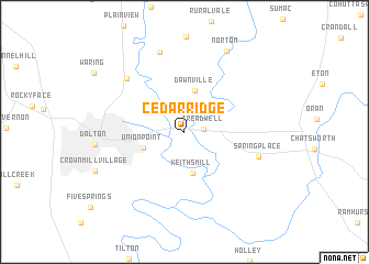
Cedar Ridge (Georgia, United States - USA)Cedar Ridge is a town in the Georgia region of United States - USA. An overview map of the region around Cedar Ridge is displayed below.
regional and 3d topo map of Cedar Ridge, United States - USA ::
Cedar Ridge airports ::
The nearest airport is CHA - Chattanooga Lovell Fld, located 40.3 km north west of Cedar Ridge.
Other airports nearby include MGE - Marietta Dobbins Arb (Atlanta Nas) (102.0 km south), ATL - Hartsfield Jackson Atlanta Intl (133.9 km south), TYS - Knoxville Mc Ghee Tyson (140.3 km north east), ANB - Anniston Metro (159.7 km south west), Nearby towns ::
Treadwell (1.7km east) //
Keiths Mill (4.3km south) //
Dawnville (4.3km north) //
Union Point (3.8km south west) //
Spring Place (6.7km east) //
Pleasant Grove (7.2km north west) //
Cedar Valley (8.4km north) //
Norton (8.9km north east) //
[all distances 'as the bird flies' and approximate] 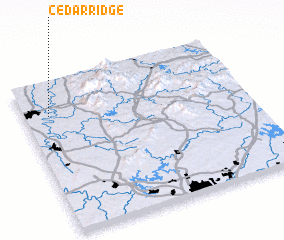 Places with similar names to Cedar Ridge, United States - USA ::
// Strugi (RU)
// Strugi (RU)
// Cedar Ridge (US)
// Cedar Ridge (US)
// Cedar Ridge (US)
// Cedaredge (US)
// Cedar Ridge (US)
// Store Eige (NO)
// Strugi (PL)
// Strugi (PL)
Disclaimer :: Information on this page comes without warranty of any kind |
||
|
Where is Cedar Ridge? Elevation and coordinates ::
Latitude (lat): 34°46'52"N Longitude (lon): 84°53'20"W
Elevation (approx.): 222m (map arrows pan, magnifying glasses zoom) |
||
|
Visiting Cedar Ridge? Hotel/Accommodation ::
Book a hotel in Cedar Ridge Travel Guide ::
rental cars ::
car rental offers GPS waypoint ::
download a GPX waypoint (PoI) of Cedar Ridge for your GPS receiver
|
||