|
search place name
|
||
Hall Mill (Georgia, United States - USA)Hall Mill is a town in the Georgia region of United States - USA. An overview map of the region around Hall Mill is displayed below.
regional and 3d topo map of Hall Mill, United States - USA ::

Hall Mill airports ::
The nearest airport is CHA - Chattanooga Lovell Fld, located 31.2 km north east of Hall Mill.
Other airports nearby include HUA - Redstone Aaf (122.3 km west), MGE - Marietta Dobbins Arb (Atlanta Nas) (123.4 km south east), ANB - Anniston Metro (140.4 km south), ATL - Hartsfield Jackson Atlanta Intl (153.3 km south east), Nearby towns ::
Kensington (1.9km south west) //
Davis Crossroads (3.3km south) //
Estelle (4.3km south) //
Cooper Heights (4.0km north west) //
Cassandra (3.9km west) //
Valley Head (5.0km south east) //
Pond Spring (5.1km north east) //
Marsh Crossing (7.8km south) //
High Point (9.0km north) //
Ascalon (8.9km north west) //
Thompsonville (10.1km north west) //
Cedar Grove (9.8km south west) //
Linwood (9.9km south east) //
Durham (10.9km north west) //
LaFayette (11.0km south east) //
[all distances 'as the bird flies' and approximate] 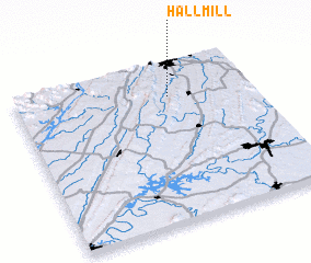 Places with similar names to Hall Mill, United States - USA ::
// Hollmühle (DE)
// Haliimaile (US)
// Holmeli (NO)
// Holmli (NO)
// Ħal Mula (MT)
// Hilmilo (ET)
// Hale Mill (US)
// Hull Mill (US)
// Helimele (GH)
// Haliamulla (LK)
Disclaimer :: Information on this page comes without warranty of any kind |
||
|
Where is Hall Mill? Elevation and coordinates ::
Latitude (lat): 34°47'0"N Longitude (lon): 85°21'21"W
Elevation (approx.): 241m (map arrows pan, magnifying glasses zoom) |
||
|
Visiting Hall Mill? Hotel/Accommodation ::
Book a hotel in Hall Mill Travel Guide ::
rental cars ::
car rental offers GPS waypoint ::
download a GPX waypoint (PoI) of Hall Mill for your GPS receiver
|
||