|
search place name
|
||
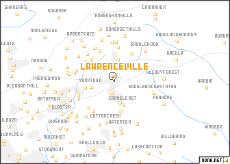
Lawrenceville (Georgia, United States - USA)Lawrenceville is a town in the Georgia region of United States - USA. An overview map of the region around Lawrenceville is displayed below.
regional and 3d topo map of Lawrenceville, United States - USA ::
Lawrenceville airports ::
The nearest airport is MGE - Marietta Dobbins Arb (Atlanta Nas), located 49.0 km west of Lawrenceville.
Other airports nearby include ATL - Hartsfield Jackson Atlanta Intl (54.0 km south west), AND - Andersen Anderson Rgnl (132.1 km north east), MCN - Macon Middle Georgia Rgnl (143.6 km south), WRB - Macon Robins Afb (150.5 km south), Nearby towns ::
Forest Hills (1.9km south) //
Forest River (3.1km north) //
Oakdale Woods (3.5km south) //
Allendale (3.7km north) //
Yorktown (3.3km west) //
Carmel East (3.9km south) //
Timbercrest (4.9km south) //
Summerville (4.1km west) //
Oakbrook Forest (4.8km north west) //
Gunter Estates (5.2km north east) //
Ridgewood (5.7km north) //
Country Park (5.6km north west) //
Fairview Station (5.1km north west) //
Bristol Downs (5.5km south west) //
Inglenook (5.5km south west) //
La Mancha (5.3km west) //
Murphy Estates (5.4km south west) //
Woodhaven Downs (6.4km north) //
Marsh Creek (5.9km north west) //
Oak Village (6.2km north west) //
The Circles (6.5km north) //
River Colony (5.5km west) //
Murphyville (5.7km south west) //
Saddleback Estates (5.6km east) //
Cotton Creek (6.8km south) //
Jackson Township (5.7km west) //
Saddlewood (6.5km north east) //
Pine Ridge Country Club Estates (7.1km north) //
Hunting Creek (6.5km north west) //
[all distances 'as the bird flies' and approximate] 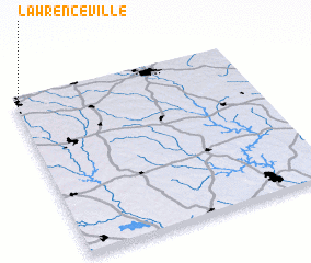 Places with similar names to Lawrenceville, United States - USA ::
// Lawrenceville (US)
// Lawrenceville (US)
// Lawrenceville (US)
// Lawrenceville (US)
// Lawrenceville (US)
// Lawrenceville (US)
// Lawrenceville (US)
// Lawrenceville (US)
// Lawrenceville (US)
// Lawrenceville (US)
Disclaimer :: Information on this page comes without warranty of any kind |
||
|
Where is Lawrenceville? Elevation and coordinates ::
Latitude (lat): 33°57'22"N Longitude (lon): 83°59'17"W
Elevation (approx.): 326m (map arrows pan, magnifying glasses zoom) |
||
|
Visiting Lawrenceville? Hotel/Accommodation ::
Book a hotel in Lawrenceville Travel Guide ::
rental cars ::
car rental offers GPS waypoint ::
download a GPX waypoint (PoI) of Lawrenceville for your GPS receiver
|
||