|
search place name
|
||
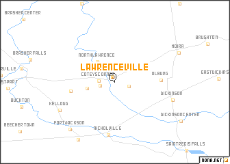
Lawrenceville (New York, United States - USA)Lawrenceville is a town in the New York region of United States - USA. An overview map of the region around Lawrenceville is displayed below.
regional and 3d topo map of Lawrenceville, United States - USA ::
Lawrenceville airports ::
The nearest airport is MSS - Massena Intl Richards Fld, located 23.6 km north west of Lawrenceville.
Other airports nearby include YOW - Ottawa Macdonald Cartier Intl (100.7 km north west), YUL - Montreal Pierre Elliott Trudeau Intl (105.3 km north east), YND - Gatineau (109.8 km north west), YMX - Montreal Intl Mirabel (111.4 km north east), Nearby towns ::
Taylors Corner (1.8km south east) //
Laverys Corner (1.8km west) //
Coteys Corner (1.8km west) //
North Lawrence (3.9km north west) //
McEwens Corner (3.3km west) //
Wagstaff Corner (5.3km west) //
Alburg (5.4km east) //
Nicholville (8.7km south) //
Fort Jackson (9.3km south west) //
[all distances 'as the bird flies' and approximate] 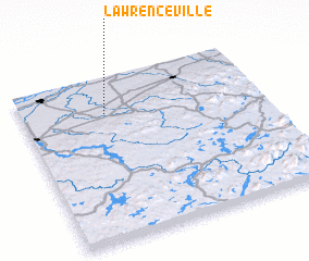 Places with similar names to Lawrenceville, United States - USA ::
// Lawrenceville (US)
// Lawrenceville (US)
// Lawrenceville (US)
// Lawrenceville (US)
// Lawrenceville (US)
// Lawrenceville (US)
// Lawrenceville (US)
// Lawrenceville (US)
// Lawrenceville (US)
// Lawrenceville (US)
Disclaimer :: Information on this page comes without warranty of any kind |
||
|
Where is Lawrenceville? Elevation and coordinates ::
Latitude (lat): 44°46'30"N Longitude (lon): 74°39'0"W
Elevation (approx.): 140m (map arrows pan, magnifying glasses zoom) |
||
|
Visiting Lawrenceville? Hotel/Accommodation ::
Book a hotel in Lawrenceville Travel Guide ::
rental cars ::
car rental offers GPS waypoint ::
download a GPX waypoint (PoI) of Lawrenceville for your GPS receiver
|
||