|
search place name
|
||
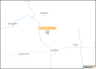
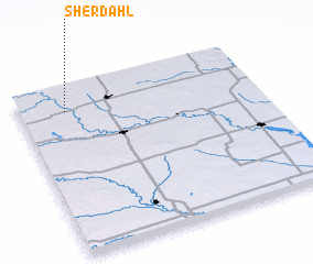
Sherdahl (Kansas, United States - USA)Sherdahl is a town in the Kansas region of United States - USA. An overview map of the region around Sherdahl is displayed below.
regional and 3d topo map of Sherdahl, United States - USA ::
Sherdahl airports ::
The nearest airport is FRI - Fort Riley Marshall Aaf, located 126.4 km south east of Sherdahl.
Other airports nearby include LNK - Lincoln (141.8 km north east), OFF - Omaha Offutt Afb (213.2 km north east), OMA - Omaha Eppley Afld (228.1 km north east), Nearby towns ::
 Places with similar names to Sherdahl, United States - USA ::
// Shortly (US)
// Chertaly (RU)
// Chartley (US)
// Chartley (US)
// Cherry Dale (US)
// Shortall (US)
// Cherrydale (US)
// Cherrydale (US)
// Chāritala (BD)
// Char Tilli (BD)
Disclaimer :: Information on this page comes without warranty of any kind |
||
|
Where is Sherdahl? Elevation and coordinates ::
Latitude (lat): 39°51'25"N Longitude (lon): 97°48'28"W
Elevation (approx.): 447m (map arrows pan, magnifying glasses zoom) |
||
|
Visiting Sherdahl? Hotel/Accommodation ::
Book a hotel in Sherdahl Travel Guide ::
rental cars ::
car rental offers GPS waypoint ::
download a GPX waypoint (PoI) of Sherdahl for your GPS receiver
|
||