|
search place name
|
||
Chartley (Maryland, United States - USA)Chartley is a town in the Maryland region of United States - USA. An overview map of the region around Chartley is displayed below.
regional and 3d topo map of Chartley, United States - USA ::

Chartley airports ::
The nearest airport is BWI - Baltimore Washington Intl, located 33.9 km south of Chartley.
Other airports nearby include APG - Aberdeen Phillips Aaf (55.4 km east), DCA - Ronald Reagan Washington Natl (70.2 km south), ADW - Camp Springs Andrews Afb (Washington Dc Naf) (72.2 km south), IAD - Washington Dulles Intl (79.7 km south west), Nearby towns ::
Worthington Meadows (0.5km north) //
Saint Georges (0.8km north east) //
Village of Timber Grove (0.8km south east) //
Glyndon Greens (0.9km north west) //
Suburbia (1.0km south east) //
Tree Top Station (1.0km north east) //
Crandon (1.2km north) //
Hunters Glen South (1.1km south east) //
Sagamore Village (1.3km north east) //
Cherry Valley (1.5km south) //
Timber Grove (1.3km east) //
Academy Acres (1.6km south east) //
Timber Chase (1.3km east) //
Westbury (1.6km south west) //
Glyndon (1.9km north) //
Sagamore Forest (1.7km north east) //
Hathaway (2.0km south) //
Reisterstown (1.8km north west) //
Delight (2.2km south) //
Worthington Run (1.8km east) //
Fox Haven Estates (2.4km south) //
Worthington Glen (1.9km east) //
Arborwood (1.9km east) //
Emory Grove (2.5km north) //
Cedarmere (2.7km south) //
Hunters Glen (2.2km east) //
Kendig Mill Station (2.5km south east) //
The Manors (2.3km east) //
Velvet Hills (2.4km east) //
[all distances 'as the bird flies' and approximate] 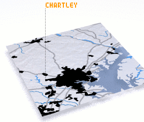 Places with similar names to Chartley, United States - USA ::
// Shortly (US)
// Chertaly (RU)
// Sherdahl (US)
// Chartley (US)
// Cherry Dale (US)
// Shortall (US)
// Cherrydale (US)
// Cherrydale (US)
// Chāritala (BD)
// Char Tilli (BD)
Disclaimer :: Information on this page comes without warranty of any kind |
||
|
Where is Chartley? Elevation and coordinates ::
Latitude (lat): 39°27'34"N Longitude (lon): 76°48'46"W
Elevation (approx.): 198m (map arrows pan, magnifying glasses zoom) |
||
|
Visiting Chartley? Hotel/Accommodation ::
Book a hotel in Chartley Travel Guide ::
rental cars ::
car rental offers GPS waypoint ::
download a GPX waypoint (PoI) of Chartley for your GPS receiver
|
||