|
search place name
|
||
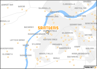
Saint Denis (Kentucky, United States - USA)Saint Denis is a town in the Kentucky region of United States - USA. An overview map of the region around Saint Denis is displayed below.
regional and 3d topo map of Saint Denis, United States - USA ::
Saint Denis airports ::
The nearest airport is LOU - Louisville Bowman Fld, located 15.1 km east of Saint Denis.
Other airports nearby include FTK - Fort Knox Godman Aaf (34.8 km south), CVG - Cincinnati Northern Kentucky Intl (138.5 km north east), LUK - Cincinnati Muni Lunken Fld (158.8 km north east), IND - Indianapolis Intl (173.1 km north), Nearby towns ::
Heatherfield (0.6km north east) //
Shively (0.9km east) //
St. Dennis (1.7km south west) //
Hunters Trace (3.1km south) //
South Parkland (3.7km north east) //
Riverside Gardens (3.6km west) //
Parkland (4.9km north) //
Jacobs Addition (4.0km east) //
Parkwood (5.7km south east) //
Shawneeland (6.0km north) //
Oakdale (4.9km east) //
Hazelwood (5.2km south east) //
Sylvania (6.0km south west) //
Southern Heights (5.5km east) //
Wilder Park (5.9km east) //
Buchanan (6.1km west) //
Portland (7.9km north) //
Beechmont (6.5km east) //
Kenwood (6.9km south east) //
Waverly Hills (8.5km south) //
Bridgeport (6.9km south west) //
Locust Point (7.3km south west) //
Highland Park (7.2km east) //
Auburndale (8.2km south east) //
Greenwood (8.1km south west) //
Salina (8.6km south west) //
Louisville (8.8km north east) //
[all distances 'as the bird flies' and approximate] 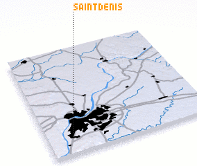 Places with similar names to Saint Denis, United States - USA ::
// Saint Denis (US)
// Sondeh Densay (GM)
// Saint-Denis (CA)
// Saint-Denis (FR)
// Saint-Denis (FR)
// Saint-Denis (FR)
// Saint-Denis (FR)
// Saint-Denis (BE)
// Saint Dionizy (FR)
// Saint-Denis (CA)
Disclaimer :: Information on this page comes without warranty of any kind |
||
|
Where is Saint Denis? Elevation and coordinates ::
Latitude (lat): 38°12'1"N Longitude (lon): 85°49'59"W
Elevation (approx.): 139m (map arrows pan, magnifying glasses zoom) |
||
|
Visiting Saint Denis? Hotel/Accommodation ::
Book a hotel in Saint Denis Travel Guide ::
rental cars ::
car rental offers GPS waypoint ::
download a GPX waypoint (PoI) of Saint Denis for your GPS receiver
|
||