|
search place name
|
||
Saint Denis (Maryland, United States - USA)Saint Denis is a town in the Maryland region of United States - USA. An overview map of the region around Saint Denis is displayed below.
regional and 3d topo map of Saint Denis, United States - USA ::

Saint Denis airports ::
The nearest airport is BWI - Baltimore Washington Intl, located 6.1 km south east of Saint Denis.
Other airports nearby include ADW - Camp Springs Andrews Afb (Washington Dc Naf) (47.8 km south), DCA - Ronald Reagan Washington Natl (50.2 km south west), APG - Aberdeen Phillips Aaf (53.6 km north east), IAD - Washington Dulles Intl (71.9 km south west), Nearby towns ::
Relay (0.6km north) //
Hilton Place (0.7km north east) //
Richardson Mews (0.9km north) //
Elkridge (1.4km south west) //
Huntsmoor South (1.6km north) //
Wynnewood (1.5km north east) //
Elkridge Heights (1.6km south west) //
Lawyers Hill (1.5km west) //
Mount Augustine (1.8km south west) //
Avalon (1.6km north west) //
Ramsgate News (2.0km north) //
Patapsco (1.8km south east) //
Arbour Manor (2.3km north) //
Canbury Woods (2.3km south west) //
Ehrmansville (2.7km south) //
Cowdensville (2.7km north) //
Glenartney (2.2km north west) //
West Elkridge (2.6km south west) //
Shirley Heights (2.4km east) //
Halethorpe (2.8km north east) //
Montgomery Manor (2.8km south west) //
Oak Park (2.8km north east) //
Montgomery Woods (2.9km south west) //
Arbutus (3.6km north) //
Rockburn Commons (3.0km south west) //
Foxhall Farm (3.3km north west) //
Quail Ridge (3.1km south west) //
Hanover (3.7km south west) //
Knollview (3.8km north) //
[all distances 'as the bird flies' and approximate] 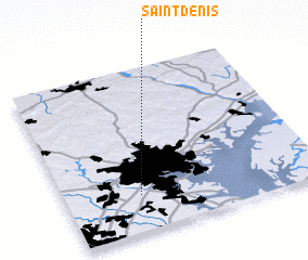 Places with similar names to Saint Denis, United States - USA ::
// Saint Denis (US)
// Sondeh Densay (GM)
// Saint-Denis (CA)
// Saint-Denis (FR)
// Saint-Denis (FR)
// Saint-Denis (FR)
// Saint-Denis (FR)
// Saint-Denis (BE)
// Saint Dionizy (FR)
// Saint-Denis (CA)
Disclaimer :: Information on this page comes without warranty of any kind |
||
|
Where is Saint Denis? Elevation and coordinates ::
Latitude (lat): 39°13'21"N Longitude (lon): 76°42'18"W
Elevation (approx.): 18m (map arrows pan, magnifying glasses zoom) |
||
|
Visiting Saint Denis? Hotel/Accommodation ::
Book a hotel in Saint Denis Travel Guide ::
rental cars ::
car rental offers GPS waypoint ::
download a GPX waypoint (PoI) of Saint Denis for your GPS receiver
|
||