|
search place name
|
||
Scottown (Kentucky, United States - USA)Scottown is a town in the Kentucky region of United States - USA. An overview map of the region around Scottown is displayed below.
regional and 3d topo map of Scottown, United States - USA ::

Scottown airports ::
The nearest airport is HOP - Hopkinsville Campbell Aaf, located 86.7 km south west of Scottown.
Other airports nearby include FTK - Fort Knox Godman Aaf (109.0 km north east), BNA - Nashville Intl (135.5 km south), LOU - Louisville Bowman Fld (152.4 km north east), MKL - Jackson Mc Kellar Sipes Rgnl (259.1 km south west), Nearby towns ::
Echols (1.2km north) //
Nineteen (1.7km east) //
Ken Wye (2.7km north east) //
Rockport (3.0km north west) //
Simmons (4.3km north east) //
Paradise (6.3km south) //
Martwick (5.2km west) //
McHenry (7.6km north east) //
Wysox (7.5km south east) //
Ceralvo (7.5km north west) //
[all distances 'as the bird flies' and approximate] 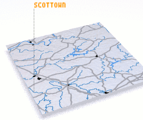 Places with similar names to Scottown, United States - USA ::
// Souktana (MA)
// São Caetano (BR)
// São Caetano (BR)
// São Caetano (BR)
// São Caetano (BR)
// São Caetano (BR)
// São Caetano (BR)
// São Caetano (BR)
// São Caetano (BR)
// São Caetano (BR)
Disclaimer :: Information on this page comes without warranty of any kind |
||
|
Where is Scottown? Elevation and coordinates ::
Latitude (lat): 37°19'23"N Longitude (lon): 86°57'55"W
Elevation (approx.): 162m (map arrows pan, magnifying glasses zoom) |
||
|
Visiting Scottown? Hotel/Accommodation ::
Book a hotel in Scottown Travel Guide ::
rental cars ::
car rental offers GPS waypoint ::
download a GPX waypoint (PoI) of Scottown for your GPS receiver
|
||