|
search place name
|
||
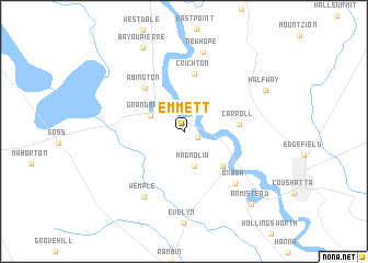
Emmett (Louisiana, United States - USA)Emmett is a town in the Louisiana region of United States - USA. An overview map of the region around Emmett is displayed below.
regional and 3d topo map of Emmett, United States - USA ::
Emmett airports ::
The nearest airport is BAD - Shreveport Barksdale Afb, located 52.0 km north west of Emmett.
Other airports nearby include SHV - Shreveport Rgnl (55.1 km north west), POE - Fort Polk Polk Aaf (116.3 km south), AEX - Alexandria Intl (118.2 km south east), GGG - Longview East Texas Rgnl (124.5 km west), Nearby towns ::
Harmon (1.3km south east) //
Magnolia (3.7km south) //
Grand Bayou (3.3km north west) //
Gahagan (4.9km south east) //
Carroll (4.9km east) //
Crichton (5.9km north) //
Abington (5.6km north west) //
Oxbow (6.9km south east) //
Wemple (7.5km south west) //
New Hope (8.3km north) //
Halfway (8.2km north east) //
Bayou Pierre (9.2km north) //
Armistead (9.4km south east) //
[all distances 'as the bird flies' and approximate]  Places with similar names to Emmett, United States - USA ::
Disclaimer :: Information on this page comes without warranty of any kind |
||
|
Where is Emmett? Elevation and coordinates ::
Latitude (lat): 32°4'18"N Longitude (lon): 93°26'33"W
Elevation (approx.): 45m (map arrows pan, magnifying glasses zoom) |
||
|
Visiting Emmett? Hotel/Accommodation ::
Book a hotel in Emmett Travel Guide ::
rental cars ::
car rental offers GPS waypoint ::
download a GPX waypoint (PoI) of Emmett for your GPS receiver
|
||