|
search place name
|
||
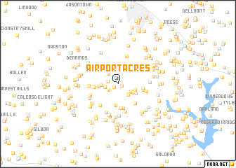
Airport Acres (Maryland, United States - USA)Airport Acres is a town in the Maryland region of United States - USA. An overview map of the region around Airport Acres is displayed below.
regional and 3d topo map of Airport Acres, United States - USA ::
Airport Acres airports ::
The nearest airport is BWI - Baltimore Washington Intl, located 43.9 km south east of Airport Acres.
Other airports nearby include DCA - Ronald Reagan Washington Natl (67.9 km south), IAD - Washington Dulles Intl (69.1 km south west), APG - Aberdeen Phillips Aaf (72.9 km east), ADW - Camp Springs Andrews Afb (Washington Dc Naf) (73.6 km south), Nearby towns ::
Olde Washington Valley (0.5km south east) //
Elbeekay Farms (0.7km south west) //
Huntfield (1.3km west) //
Montclare (1.5km south west) //
Academy Acres (1.7km west) //
Bloom (1.9km north west) //
Benders Heights (2.1km south east) //
Carroll Park (1.9km south east) //
Heritage (2.2km south east) //
Bar-Klee Estates (2.1km south east) //
Hazels Woods (2.4km north) //
Legos Choice (2.0km west) //
Presidential Park (2.3km south east) //
Sunset Hill (2.4km south east) //
Ray-Mar Estates (2.4km west) //
Gist (2.7km south east) //
Bushey Heights (3.4km south) //
Nicodemus Heights (3.2km north east) //
Fieldcrest (3.3km north east) //
Wellwood (3.3km north east) //
Winfield Woods (2.9km west) //
Equestrian Estates (3.9km south) //
Dorsey Crossroads (3.9km south) //
Maple Haven (3.2km east) //
Wilson Terrace (3.8km south east) //
Klees Mill Terrace (3.3km east) //
Stone House Village (4.1km south west) //
Piney Run Estates (4.5km south) //
Winfield Heights (3.6km west) //
[all distances 'as the bird flies' and approximate] 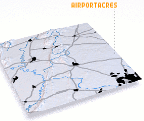 Places with similar names to Airport Acres, United States - USA ::
// Airport Acres (US)
Disclaimer :: Information on this page comes without warranty of any kind |
||
|
Where is Airport Acres? Elevation and coordinates ::
Latitude (lat): 39°27'50"N Longitude (lon): 77°0'57"W
Elevation (approx.): 243m (map arrows pan, magnifying glasses zoom) |
||
|
Visiting Airport Acres? Hotel/Accommodation ::
Book a hotel in Airport Acres Travel Guide ::
rental cars ::
car rental offers GPS waypoint ::
download a GPX waypoint (PoI) of Airport Acres for your GPS receiver
|
||