|
search place name
|
||
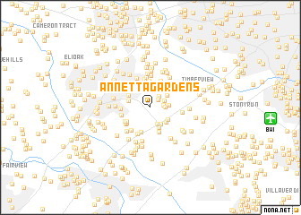
Annetta Gardens (Maryland, United States - USA)Annetta Gardens is a town in the Maryland region of United States - USA. An overview map of the region around Annetta Gardens is displayed below.
regional and 3d topo map of Annetta Gardens, United States - USA ::
Annetta Gardens airports ::
The nearest airport is BWI - Baltimore Washington Intl, located 11.7 km east of Annetta Gardens.
Other airports nearby include ADW - Camp Springs Andrews Afb (Washington Dc Naf) (42.3 km south), DCA - Ronald Reagan Washington Natl (42.5 km south west), IAD - Washington Dulles Intl (62.6 km south west), APG - Aberdeen Phillips Aaf (62.8 km north east), Nearby towns ::
Pfeiffer Corners (1.3km north east) //
Deep Run Park (1.3km east) //
Locust Manor (1.6km north east) //
Village of Deep Run (1.4km east) //
Thompsons Purchase (1.6km north east) //
Washington Manor (2.2km south) //
Mayfield Manor (1.8km east) //
Cedars (2.3km south east) //
Woodland Village (2.2km north east) //
Aladdin Village Trailer Park (2.3km south east) //
Peter Harmond Acres (2.7km north) //
Waterloo (2.4km south east) //
Villa Heights (2.6km south) //
Sewells Orchard (2.3km west) //
Campbell (2.9km south) //
Jeffers Hill (2.6km north west) //
Long Reach (3.1km north) //
Maple Trailer Park (3.2km south) //
Mission Heights (3.2km south) //
Montgomery Run (3.3km north) //
Brightfield (3.1km north east) //
Oak View Village (2.9km south west) //
Guilford Gardens (3.0km south west) //
Hunt Country Estates (3.4km north) //
Locust Park (3.2km north west) //
Barrington Woods (3.6km north) //
Guilford Square (3.0km south west) //
Heritage Woods (3.6km south) //
Guilford (3.2km south west) //
[all distances 'as the bird flies' and approximate] 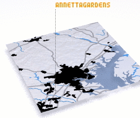 Places with similar names to Annetta Gardens, United States - USA :: Disclaimer :: Information on this page comes without warranty of any kind |
||
|
Where is Annetta Gardens? Elevation and coordinates ::
Latitude (lat): 39°11'18"N Longitude (lon): 76°48'11"W
Elevation (approx.): 104m (map arrows pan, magnifying glasses zoom) |
||
|
Visiting Annetta Gardens? Hotel/Accommodation ::
Book a hotel in Annetta Gardens Travel Guide ::
rental cars ::
car rental offers GPS waypoint ::
download a GPX waypoint (PoI) of Annetta Gardens for your GPS receiver
|
||