|
search place name
|
||
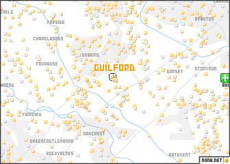
Guilford (Maryland, United States - USA)Guilford is a town in the Maryland region of United States - USA. An overview map of the region around Guilford is displayed below.
regional and 3d topo map of Guilford, United States - USA ::
Guilford airports ::
The nearest airport is BWI - Baltimore Washington Intl, located 14.1 km east of Guilford.
Other airports nearby include DCA - Ronald Reagan Washington Natl (39.6 km south west), ADW - Camp Springs Andrews Afb (Washington Dc Naf) (40.0 km south), IAD - Washington Dulles Intl (59.6 km south west), APG - Aberdeen Phillips Aaf (65.9 km north east), Nearby towns ::
Guilford Gardens (0.2km north east) //
Guilford Square (0.4km north) //
Oak View Village (0.4km north) //
Glen Oaks (0.8km south) //
Glenshire Towne (1.0km south east) //
Hopewell (1.2km north) //
Huntington (1.6km south west) //
Huntington East (1.9km south) //
Heritage Woods (1.7km south east) //
Elkhorn (2.0km north) //
Mission Heights (1.7km south east) //
Aspenwood (2.4km south east) //
Owen Brown (2.4km north west) //
Woodvalley (2.1km west) //
Nordeau (2.6km south east) //
Stonebrook (2.2km west) //
Asbury Woods (2.8km south east) //
Sewells Orchard (2.9km north) //
Dasher Green (2.8km north west) //
Autumn Woods (3.1km south) //
Carriage Hills (2.6km west) //
Howard Hills (3.4km south) //
Glen Court (3.2km south east) //
Jeffers Hill (3.5km north) //
Stevens Forest (3.4km north) //
Savage (3.6km south) //
Annetta Gardens (3.2km north east) //
MacGills Common (3.0km north west) //
River Island (3.9km south) //
[all distances 'as the bird flies' and approximate] 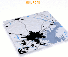 Places with similar names to Guilford, United States - USA ::
Disclaimer :: Information on this page comes without warranty of any kind |
||
|
Where is Guilford? Elevation and coordinates ::
Latitude (lat): 39°10'11"N Longitude (lon): 76°49'51"W
Elevation (approx.): 114m (map arrows pan, magnifying glasses zoom) |
||
|
Visiting Guilford? Hotel/Accommodation ::
Book a hotel in Guilford Travel Guide ::
rental cars ::
car rental offers GPS waypoint ::
download a GPX waypoint (PoI) of Guilford for your GPS receiver
|
||