|
search place name
|
||
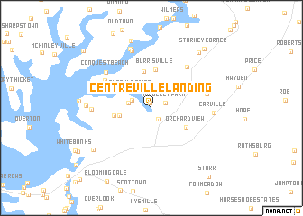
Centreville Landing (Maryland, United States - USA)Centreville Landing is a town in the Maryland region of United States - USA. An overview map of the region around Centreville Landing is displayed below.
regional and 3d topo map of Centreville Landing, United States - USA ::
Centreville Landing airports ::
The nearest airport is APG - Aberdeen Phillips Aaf, located 46.4 km north of Centreville Landing.
Other airports nearby include BWI - Baltimore Washington Intl (53.1 km west), DOV - Dover Afb (53.2 km east), ADW - Camp Springs Andrews Afb (Washington Dc Naf) (73.9 km west), ILG - Wilmington New Castle (80.1 km north east), Nearby towns ::
Corsica Landing Estates (0.6km north) //
Centreville (1.6km south east) //
Kimberly Park (1.5km north east) //
Earles Branch (2.1km north west) //
Woodstream (2.3km west) //
Pusey Landing (2.8km north west) //
Brownsville (3.2km west) //
Deerfield (4.5km north) //
Burrisville (4.7km north) //
Hunters Ridge (3.8km west) //
Corsica Landing (4.0km north west) //
Orchard View (4.2km south east) //
River Estates (5.6km north west) //
Browns Corner (6.1km north east) //
Conquest Beach (6.1km north west) //
Tall Timbers Estates (5.7km east) //
Recovery (5.7km west) //
Indian Town (7.4km north) //
Ashland Landing (7.6km north) //
Earle Landing (6.2km north west) //
Carville (6.1km east) //
Pioneer Point Farms (6.3km west) //
Bulle Rock (6.3km west) //
Quaker Neck Landing (8.6km north) //
Baker (7.7km south west) //
Sparks Corner (8.2km north east) //
Starkey Corner (8.9km north east) //
Cliffs City (9.7km north west) //
Starr (10.1km south east) //
[all distances 'as the bird flies' and approximate]  Places with similar names to Centreville Landing, United States - USA :: Disclaimer :: Information on this page comes without warranty of any kind |
||
|
Where is Centreville Landing? Elevation and coordinates ::
Latitude (lat): 39°3'17"N Longitude (lon): 76°4'26"W
Elevation (approx.): 3m (map arrows pan, magnifying glasses zoom) |
||
|
Visiting Centreville Landing? Hotel/Accommodation ::
Book a hotel in Centreville Landing Travel Guide ::
rental cars ::
car rental offers GPS waypoint ::
download a GPX waypoint (PoI) of Centreville Landing for your GPS receiver
|
||