|
search place name
|
||
Davis (Maryland, United States - USA)Davis is a town in the Maryland region of United States - USA. An overview map of the region around Davis is displayed below.
regional and 3d topo map of Davis, United States - USA ::

Davis airports ::
The nearest airport is BWI - Baltimore Washington Intl, located 49.4 km east of Davis.
Other airports nearby include IAD - Washington Dulles Intl (49.8 km south west), DCA - Ronald Reagan Washington Natl (56.5 km south), ADW - Camp Springs Andrews Afb (Washington Dc Naf) (65.9 km south east), APG - Aberdeen Phillips Aaf (89.6 km east), Nearby towns ::
Samhill Estates (0.7km north east) //
Skyline Woods (0.9km north west) //
Skyline Manor (0.8km south west) //
Treasure Mountain (1.4km north) //
Rolling Hills (1.2km north east) //
Park Lake Estates (1.3km south west) //
Langdon Woods (1.4km north east) //
Rattle Ridge (1.6km south west) //
East Rolling Hills (1.6km north east) //
Mill Bottom (1.9km north east) //
Harvest Ridge (2.1km north) //
Bicentennial Estates (1.8km south west) //
Kelly Ridge (2.6km north) //
Hawthorne Acres (2.9km north) //
Molesworth Hills (2.3km west) //
Fox Ridge Estates (2.8km south west) //
Friendship Knolls (2.9km south) //
Four County Farm (2.4km north east) //
Claggettsville (3.2km south) //
Sundown Manor (2.8km south west) //
Kemptown (2.8km west) //
Smith Village (3.0km west) //
Wolf Den Spring (2.9km west) //
Stonelake (3.0km west) //
Kittyhawk Estates (3.1km south west) //
Ridgeville (3.5km north east) //
Bradford Estates (3.5km north west) //
Farmfield Estates (3.3km west) //
Friendship (4.3km south) //
[all distances 'as the bird flies' and approximate] 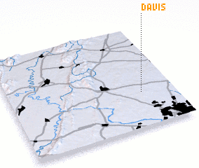 Places with similar names to Davis, United States - USA ::
Disclaimer :: Information on this page comes without warranty of any kind |
||
|
Where is Davis? Elevation and coordinates ::
Latitude (lat): 39°20'44"N Longitude (lon): 77°11'50"W
Elevation (approx.): 249m (map arrows pan, magnifying glasses zoom) |
||
|
Visiting Davis? Hotel/Accommodation ::
Book a hotel in Davis Travel Guide ::
rental cars ::
car rental offers GPS waypoint ::
download a GPX waypoint (PoI) of Davis for your GPS receiver
|
||