|
search place name
|
||
Deer Creek (Maryland, United States - USA)Deer Creek is a town in the Maryland region of United States - USA. An overview map of the region around Deer Creek is displayed below.
regional and 3d topo map of Deer Creek, United States - USA ::
Deer Creek airports ::
The nearest airport is BWI - Baltimore Washington Intl, located 23.5 km north west of Deer Creek.
Other airports nearby include ADW - Camp Springs Andrews Afb (Washington Dc Naf) (43.6 km south west), APG - Aberdeen Phillips Aaf (53.5 km north east), DCA - Ronald Reagan Washington Natl (54.3 km west), NHK - Patuxent River Nas (83.8 km south), Nearby towns ::
Greenholly (0.6km north) //
Briarwood (0.8km south) //
Atlantis (0.8km north east) //
Dorado Hills (0.7km west) //
Dorado Village (0.8km west) //
Colonial Manor Trailer Park (1.0km south west) //
Northport (1.0km west) //
Admirals Walk (1.2km south east) //
Bellerive Village (1.2km west) //
Oakland Hill (1.2km north west) //
Cape Saint Claire (1.2km east) //
Ulmstead Estates (1.5km north west) //
Point-O-Woods (1.3km west) //
Shore Acres (1.7km north) //
Walnut Ridge (1.5km south east) //
Weatherly (1.8km north) //
Old Mill Bottom Estates (1.9km south) //
Whispering Woods (1.8km south west) //
Oakmont (1.7km west) //
Saint Margarets (2.2km south) //
Stonington (2.0km north west) //
Hollyberry Woods (1.8km north west) //
Capetowne (2.0km south west) //
Ulmstead Gardens (2.2km north west) //
Tanglewood (2.1km west) //
Saint Margarets Farm (2.7km south) //
Revell Downs (2.3km south east) //
Bay Hills (2.3km north west) //
Bayberry (2.7km north west) //
[all distances 'as the bird flies' and approximate] 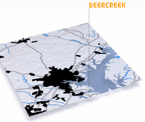 Places with similar names to Deer Creek, United States - USA ::
// Dry Creek (US)
// Deer Creek (US)
// Deer Creek (US)
// Deer Creek (US)
// Deer Creek (US)
// Deer Creek (US)
// Deer Creek (US)
// Deer Creek (US)
// Darkorak (IR)
// Darreh Gorg (IR)
Disclaimer :: Information on this page comes without warranty of any kind |
||
|
Where is Deer Creek? Elevation and coordinates ::
Latitude (lat): 39°2'24"N Longitude (lon): 76°27'33"W
Elevation (approx.): 32m (map arrows pan, magnifying glasses zoom) |
||
|
Visiting Deer Creek? Hotel/Accommodation ::
Book a hotel in Deer Creek Travel Guide ::
rental cars ::
car rental offers GPS waypoint ::
download a GPX waypoint (PoI) of Deer Creek for your GPS receiver
|
||