|
search place name
|
||
Harris Heights (Maryland, United States - USA)Harris Heights is a town in the Maryland region of United States - USA. An overview map of the region around Harris Heights is displayed below.
regional and 3d topo map of Harris Heights, United States - USA ::

Harris Heights airports ::
The nearest airport is BWI - Baltimore Washington Intl, located 46.7 km south east of Harris Heights.
Other airports nearby include APG - Aberdeen Phillips Aaf (65.0 km east), MDT - Harrisburg Intl (72.8 km north), DCA - Ronald Reagan Washington Natl (78.0 km south), IAD - Washington Dulles Intl (81.6 km south west), Nearby towns ::
Bethel (0.3km south west) //
Bethel Ridge (0.3km west) //
Zipprian Estates (0.4km south east) //
Richwynn Hill (0.6km north west) //
Carrollton (0.9km north) //
Dominos Acres (1.2km north east) //
Dell Mont (1.5km north east) //
Laura Lee Estates (1.5km south east) //
Brentwood Acres (1.5km north east) //
Shamrock Acres (1.8km south) //
Shawnee View (2.0km south) //
Lawndale Acres (2.0km south east) //
Evergreen Hills (1.9km south east) //
Yorkland (2.1km south west) //
Reese (1.9km west) //
Constance Acres (2.2km south west) //
Harper Estates (2.0km east) //
Reese Manor (2.4km south west) //
Monarch Meadow (2.6km south west) //
Sandyville (2.8km south) //
Shirley Manor (2.8km south) //
Raven Run (3.0km north) //
Patapsco (2.4km south east) //
Carroll County Trails (3.0km south) //
Village of Peachwood (2.9km south east) //
Greenbrier (3.1km north) //
Sullivans Trailer Park (3.3km south) //
Pheasant Run (3.6km south) //
Bollinger Estates (3.2km south west) //
[all distances 'as the bird flies' and approximate] 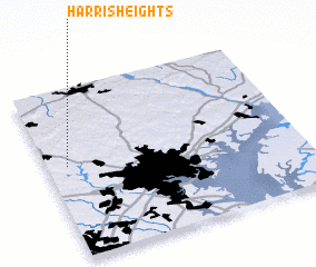 Places with similar names to Harris Heights, United States - USA ::
// Harris Heights (US)
Disclaimer :: Information on this page comes without warranty of any kind |
||
|
Where is Harris Heights? Elevation and coordinates ::
Latitude (lat): 39°32'55"N Longitude (lon): 76°55'2"W
Elevation (approx.): 224m (map arrows pan, magnifying glasses zoom) |
||
|
Visiting Harris Heights? Hotel/Accommodation ::
Book a hotel in Harris Heights Travel Guide ::
rental cars ::
car rental offers GPS waypoint ::
download a GPX waypoint (PoI) of Harris Heights for your GPS receiver
|
||