|
search place name
|
||
Patapsco (Maryland, United States - USA)Patapsco is a town in the Maryland region of United States - USA. An overview map of the region around Patapsco is displayed below.
regional and 3d topo map of Patapsco, United States - USA ::

Patapsco airports ::
The nearest airport is BWI - Baltimore Washington Intl, located 44.7 km south east of Patapsco.
Other airports nearby include APG - Aberdeen Phillips Aaf (62.7 km east), MDT - Harrisburg Intl (73.5 km north), DCA - Ronald Reagan Washington Natl (77.2 km south), ADW - Camp Springs Andrews Afb (Washington Dc Naf) (80.8 km south), Nearby towns ::
Harper Estates (0.7km north) //
Evergreen Hills (0.6km west) //
Patapsco Woods (1.4km south) //
Laura Lee Estates (1.2km west) //
Village of Peachwood (1.5km south west) //
Lawndale Acres (1.3km south west) //
Castles Rising (1.8km south) //
Shawnee View (1.7km south west) //
Shamrock Acres (1.8km west) //
Wesley Chapel (2.1km north east) //
Dominos Acres (2.2km north west) //
Brentwood Acres (2.3km north west) //
Lawndale (2.3km south east) //
Carroll County Trails (2.3km south west) //
Zipprian Estates (2.1km north west) //
Dell Mont (2.6km north west) //
Lees Mill (2.4km north east) //
Shirley Manor (2.5km south west) //
Harris Heights (2.4km north west) //
Bethel (2.5km west) //
Tabbys Delight (3.2km north) //
Kingston Riding (2.7km north east) //
Bethel Ridge (2.6km west) //
Carrollton (3.0km north west) //
Fenwood Heights (3.2km south east) //
Clydesdale Acres (2.9km south east) //
Richwynn Hill (2.9km north west) //
Southglenn Farms (3.0km south east) //
Ridgemont (3.3km south west) //
[all distances 'as the bird flies' and approximate] 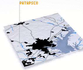
Disclaimer :: Information on this page comes without warranty of any kind |
||
|
Where is Patapsco? Elevation and coordinates ::
Latitude (lat): 39°32'19"N Longitude (lon): 76°53'32"W
Elevation (approx.): 155m (map arrows pan, magnifying glasses zoom) |
||
|
Visiting Patapsco? Hotel/Accommodation ::
Book a hotel in Patapsco Travel Guide ::
rental cars ::
car rental offers GPS waypoint ::
download a GPX waypoint (PoI) of Patapsco for your GPS receiver
|
||