|
search place name
|
||
Hunt Ridge (Maryland, United States - USA)Hunt Ridge is a town in the Maryland region of United States - USA. An overview map of the region around Hunt Ridge is displayed below.
regional and 3d topo map of Hunt Ridge, United States - USA ::

Hunt Ridge airports ::
The nearest airport is BWI - Baltimore Washington Intl, located 53.4 km south of Hunt Ridge.
Other airports nearby include APG - Aberdeen Phillips Aaf (62.6 km east), MDT - Harrisburg Intl (63.0 km north), DCA - Ronald Reagan Washington Natl (87.8 km south), ADW - Camp Springs Andrews Afb (Washington Dc Naf) (91.1 km south), Nearby towns ::
Greenmount (0.2km east) //
Maple Grove (2.0km north) //
Hampstead Heights (1.8km south east) //
Cape Hill Farms (1.7km west) //
Treelin Manor (2.1km north) //
West Hill (1.7km west) //
Glasers Hill (1.9km north west) //
Kempfield (2.1km south east) //
Wil-Mar Acres (2.0km east) //
Brilhart Terrace (2.5km south) //
Northbrook (2.9km south) //
White Oak Ridge (2.5km west) //
Ben-Har Heights (3.2km south west) //
Hampstead (3.3km south east) //
Crestview Meadows (2.9km south east) //
Gross Mill Estates (2.7km east) //
Fairmount North (2.8km north east) //
Boones Meadows (3.6km north) //
Rockbrook Trailer Park (2.9km east) //
Sunset Way (2.9km east) //
Snydersburg (3.0km south west) //
Snydersburg Manor (3.0km south west) //
Smithtown Ridge (3.6km north east) //
Hi-View Estates (3.3km north east) //
Arched Bow Valley (3.1km east) //
Manchester (3.7km north west) //
Dayspring Estates (3.1km west) //
Reeds Village (3.5km north west) //
Cape Horn South (3.4km south west) //
[all distances 'as the bird flies' and approximate] 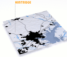 Places with similar names to Hunt Ridge, United States - USA ::
// Hunt Ridge (US)
// Huntridge (US)
Disclaimer :: Information on this page comes without warranty of any kind |
||
|
Where is Hunt Ridge? Elevation and coordinates ::
Latitude (lat): 39°37'54"N Longitude (lon): 76°51'54"W
Elevation (approx.): 244m (map arrows pan, magnifying glasses zoom) |
||
|
Visiting Hunt Ridge? Hotel/Accommodation ::
Book a hotel in Hunt Ridge Travel Guide ::
rental cars ::
car rental offers GPS waypoint ::
download a GPX waypoint (PoI) of Hunt Ridge for your GPS receiver
|
||