|
search place name
|
||
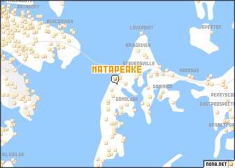
Matapeake (Maryland, United States - USA)Matapeake is a town in the Maryland region of United States - USA. An overview map of the region around Matapeake is displayed below.
regional and 3d topo map of Matapeake, United States - USA ::
Matapeake airports ::
The nearest airport is BWI - Baltimore Washington Intl, located 36.8 km north west of Matapeake.
Other airports nearby include ADW - Camp Springs Andrews Afb (Washington Dc Naf) (48.1 km west), APG - Aberdeen Phillips Aaf (58.4 km north), DCA - Ronald Reagan Washington Natl (61.2 km west), NHK - Patuxent River Nas (74.9 km south), Nearby towns ::
Bay City (0.9km north) //
Baldwin Acres (1.0km east) //
Matapeake Estates (1.2km south west) //
Normans (2.0km south) //
Sunny Isle of Kent (2.9km south west) //
Kangaroo Beach (2.7km north east) //
Chesapeake Estates (3.3km south) //
Gomoljak (3.5km south) //
Kentwood (3.8km south) //
Kent Cove (3.2km north east) //
Stevensville (3.6km north east) //
Craney Creek Estates (4.2km south) //
Shipping Creek (4.6km south) //
Claibornes Landing (4.9km south) //
Bentons Pleasure (3.8km east) //
Cox Creek Acres (4.4km south east) //
Goose Point Estates (4.8km south east) //
Harborview (4.3km east) //
Calverton (4.6km south east) //
Island View (5.0km south east) //
Queen Anne Colony (5.9km south) //
Bridge View (5.8km north east) //
Mallard Point (6.2km south) //
Cloverfields (5.6km north east) //
Cloverfields (5.7km north east) //
Skipping Creek Plantation (6.4km south) //
Mattapex (6.4km south) //
Paradise Island (6.4km south) //
Bridge Point (5.1km east) //
[all distances 'as the bird flies' and approximate] 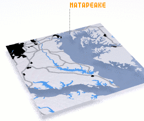 Places with similar names to Matapeake, United States - USA ::
Disclaimer :: Information on this page comes without warranty of any kind |
||
|
Where is Matapeake? Elevation and coordinates ::
Latitude (lat): 38°57'32"N Longitude (lon): 76°20'45"W
Elevation (approx.): 10m (map arrows pan, magnifying glasses zoom) |
||
|
Visiting Matapeake? Hotel/Accommodation ::
Book a hotel in Matapeake Travel Guide ::
rental cars ::
car rental offers GPS waypoint ::
download a GPX waypoint (PoI) of Matapeake for your GPS receiver
|
||