|
search place name
|
||
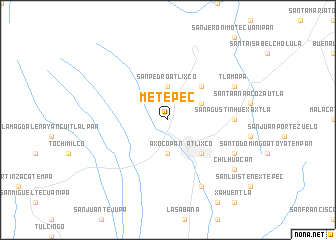
Metepec (Puebla, Mexico)Metepec is a town in the Puebla region of Mexico. An overview map of the region around Metepec is displayed below.
regional and 3d topo map of Metepec, Mexico ::
Metepec airports ::
The nearest airport is PBC - Puebla Hermanos Serdan Intl, located 26.8 km north of Metepec.
Other airports nearby include TXA - Tlaxcala (73.7 km north east), CVJ - Cuernavaca General Mariano Matamoros (84.4 km west), MEX - Mexico City Licenciado Benito Juarez Intl (84.6 km north west), TCN - Tehuacan (120.5 km south east), Nearby towns ::
Axocopan (3.7km south) //
San Baltasar Atlimeyaya (3.7km north) //
San Pedro Atlixco (3.7km north) //
San Juan Tianguismanalco (4.0km north east) //
Atlixco (5.1km south east) //
San Martín Tlapala (5.1km north east) //
San Agustín Huexaxtla (7.0km east) //
Acapulco (8.2km south east) //
San Juan Tejalucan (7.9km south east) //
Tlamapa (7.9km north east) //
Chilhuacán (8.9km south east) //
[all distances 'as the bird flies' and approximate]  Places with similar names to Metepec, Mexico ::
Disclaimer :: Information on this page comes without warranty of any kind |
||
|
Where is Metepec? Elevation and coordinates ::
Latitude (lat): 18°56'0"N Longitude (lon): 98°28'0"W
Elevation (approx.): 1947m (map arrows pan, magnifying glasses zoom) |
||
|
Visiting Metepec? Hotel/Accommodation ::
Book a hotel in Metepec Travel Guide ::
Buy a travel guide for Mexico rental cars ::
car rental offers GPS waypoint ::
download a GPX waypoint (PoI) of Metepec for your GPS receiver
|
||