|
search place name
|
||
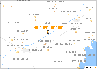
Milburn Landing (Maryland, United States - USA)Milburn Landing is a town in the Maryland region of United States - USA. An overview map of the region around Milburn Landing is displayed below.
regional and 3d topo map of Milburn Landing, United States - USA ::
Milburn Landing airports ::
The nearest airport is SBY - Salisbury Ocean City Wicomico Rgnl, located 24.0 km north of Milburn Landing.
Other airports nearby include NHK - Patuxent River Nas (82.7 km west), WWD - Wildwood Cape May Co (110.4 km north east), DOV - Dover Afb (111.6 km north), LFI - Hampton Langley Afb (138.8 km south west), Nearby towns ::
Corbin (3.4km north) //
Willow Grove (3.8km south) //
Goodwill (6.0km south) //
Wildwoods (6.9km north west) //
Owl Hollow Acres (6.6km south east) //
Harbor Acres (8.0km south west) //
Whiteburg (7.9km north west) //
Furnace (9.0km north) //
Pocomoke City (8.7km south west) //
Kirkwood Acres (10.0km north east) //
Stockton (10.6km south east) //
[all distances 'as the bird flies' and approximate]  Places with similar names to Milburn Landing, United States - USA :: Disclaimer :: Information on this page comes without warranty of any kind |
||
|
Where is Milburn Landing? Elevation and coordinates ::
Latitude (lat): 38°7'29"N Longitude (lon): 75°29'25"W
Elevation (approx.): 12m (map arrows pan, magnifying glasses zoom) |
||
|
Visiting Milburn Landing? Hotel/Accommodation ::
Book a hotel in Milburn Landing Travel Guide ::
rental cars ::
car rental offers GPS waypoint ::
download a GPX waypoint (PoI) of Milburn Landing for your GPS receiver
|
||