|
search place name
|
||
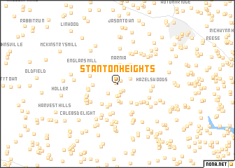
Stanton Heights (Maryland, United States - USA)Stanton Heights is a town in the Maryland region of United States - USA. An overview map of the region around Stanton Heights is displayed below.
regional and 3d topo map of Stanton Heights, United States - USA ::
Stanton Heights airports ::
The nearest airport is BWI - Baltimore Washington Intl, located 49.4 km south east of Stanton Heights.
Other airports nearby include IAD - Washington Dulles Intl (68.6 km south west), DCA - Ronald Reagan Washington Natl (70.6 km south), ADW - Camp Springs Andrews Afb (Washington Dc Naf) (77.3 km south), APG - Aberdeen Phillips Aaf (78.1 km east), Nearby towns ::
Glenvue Acres (0.3km north west) //
Dennings (0.6km north east) //
Poignant Acres (1.3km south east) //
Woodbridge (1.4km south) //
Stoney Ridge (1.9km south) //
Dulany Hills (2.0km south) //
Villa Tomarchio (1.9km south west) //
Grahams Green Acres (1.8km north east) //
Hannleigh Heights (2.4km north) //
Sun Valley Farms (2.8km south) //
Bowercrest Park (2.9km north) //
Sun Valley (3.0km south) //
Narnia (3.1km north) //
Marston (3.0km north west) //
Taylorsville (3.4km south) //
Winfield Heights (3.4km south east) //
Baile (3.4km north east) //
Dotsons Ridge (3.8km south) //
New Venture Estates (3.1km west) //
Franklinville (3.7km south west) //
Winfield Woods (3.9km south east) //
Sams Creek (3.6km west) //
Gasnell Estates (4.6km south) //
Ridgeview Estates (3.9km north east) //
Weldon (3.7km west) //
Tarson Manor (3.7km west) //
Ray-Mar Estates (4.2km south east) //
Braddock Estates (5.0km south) //
Legos Choice (4.3km south east) //
[all distances 'as the bird flies' and approximate] 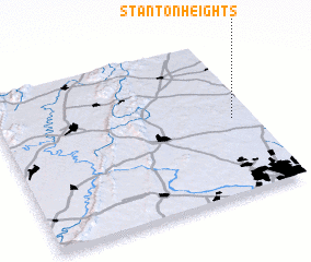 Places with similar names to Stanton Heights, United States - USA ::
Disclaimer :: Information on this page comes without warranty of any kind |
||
|
Where is Stanton Heights? Elevation and coordinates ::
Latitude (lat): 39°29'15"N Longitude (lon): 77°4'36"W
Elevation (approx.): 251m (map arrows pan, magnifying glasses zoom) |
||
|
Visiting Stanton Heights? Hotel/Accommodation ::
Book a hotel in Stanton Heights Travel Guide ::
rental cars ::
car rental offers GPS waypoint ::
download a GPX waypoint (PoI) of Stanton Heights for your GPS receiver
|
||