|
search place name
|
||
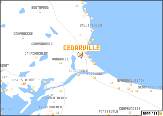
Cedarville (Massachusetts, United States - USA)Cedarville is a town in the Massachusetts region of United States - USA. An overview map of the region around Cedarville is displayed below.
regional and 3d topo map of Cedarville, United States - USA ::
Cedarville airports ::
The nearest airport is BOS - Boston General Edward Lawrence Logan Intl, located 71.9 km north west of Cedarville.
Other airports nearby include PVD - Providence Theodore Francis Green State (72.4 km west), ACK - Nantucket Mem (74.4 km south east), BED - Bedford Laurence G Hanscom Fld (95.1 km north west), CEF - Chicopee Falls Westover Arb Metropolitan (169.4 km west), Nearby towns ::
Nameloc Heights (1.4km north east) //
Cedarville Landing (1.2km east) //
Sagamore Highlands (1.7km east) //
Sagamore Beach (2.6km south east) //
Bournedale (3.9km south) //
Ellisville (4.0km north) //
Halfway Pond (3.9km north east) //
Eastland Heights (4.5km north) //
Pondville (3.8km west) //
Harlows Landing (4.7km north east) //
Plimoth Commons Mobile Home Park (5.3km north) //
Sagamore (5.0km south east) //
Bayside Beach (6.6km north) //
Vallersville (6.8km north) //
Bourne Corners (7.9km south west) //
Sandwich (7.7km south east) //
White Island Shores (6.7km west) //
Bourne (8.5km south west) //
Buzzards Bay (8.9km south west) //
Indian Heights (8.5km south west) //
Jefferson Shores (8.9km south west) //
The Springs (9.5km south east) //
Gray Gables (10.1km south west) //
[all distances 'as the bird flies' and approximate]  Places with similar names to Cedarville, United States - USA ::
// Cedarville (US)
// Star Valley (US)
// Cedarville (US)
// Seedörfl (AT)
// Cedarville (US)
// Cedar Valley (US)
// Cedar Valley (US)
// Strevell (US)
// Cedarville (US)
// Cedar Valley (US)
Disclaimer :: Information on this page comes without warranty of any kind |
||
|
Where is Cedarville? Elevation and coordinates ::
Latitude (lat): 41°48'37"N Longitude (lon): 70°33'21"W
Elevation (approx.): 23m (map arrows pan, magnifying glasses zoom) |
||
|
Visiting Cedarville? Hotel/Accommodation ::
Book a hotel in Cedarville Travel Guide ::
rental cars ::
car rental offers GPS waypoint ::
download a GPX waypoint (PoI) of Cedarville for your GPS receiver
|
||