|
search place name
|
||
East Springfield (Massachusetts, United States - USA)East Springfield is a town in the Massachusetts region of United States - USA. An overview map of the region around East Springfield is displayed below.
regional and 3d topo map of East Springfield, United States - USA ::

East Springfield airports ::
The nearest airport is CEF - Chicopee Falls Westover Arb Metropolitan, located 6.2 km north of East Springfield.
Other airports nearby include BDL - Windsor Locks Bradley Intl (24.6 km south west), HFD - Hartford Brainard (45.6 km south), PVD - Providence Theodore Francis Green State (105.1 km south east), BED - Bedford Laurence G Hanscom Fld (111.2 km east), Nearby towns ::
Athol Junction (1.5km south) //
Chicopee Falls (1.6km north west) //
McKnight and Bay (2.8km south) //
Fiberloid (2.6km north east) //
Upper Hill (3.6km south) //
Old Hill (4.2km south) //
Liberty Heights (3.5km south west) //
Pine Point (3.6km south east) //
Sandy Hill (3.9km west) //
Chicopee (3.9km west) //
Aldenville (4.6km north west) //
Mathies Manor (5.4km north) //
Springfield (5.0km south west) //
South End (5.4km south) //
North End (4.7km south west) //
East Forest Park (5.4km south east) //
Forest Park (5.8km south) //
The X (6.2km south) //
North Chicopee (5.6km north west) //
Freeman Knoll (6.4km north) //
Brightwood (5.2km south west) //
Perry Manor (6.5km north) //
Smith Highlands (6.3km north) //
Cadys Corners (5.5km north east) //
Fairview (7.0km north) //
Duncan Knoll (7.1km north) //
Indian Orchard (5.5km east) //
Sixteen Acres (5.8km south east) //
Riverdale (5.9km south west) //
[all distances 'as the bird flies' and approximate] 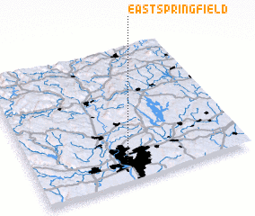 Places with similar names to East Springfield, United States - USA ::
// East Springfield (US)
// East Springfield (US)
// East Springfield (US)
// East Springfield (US)
// East Springfield (US)
Disclaimer :: Information on this page comes without warranty of any kind |
||
|
Where is East Springfield? Elevation and coordinates ::
Latitude (lat): 42°8'30"N Longitude (lon): 72°33'45"W
Elevation (approx.): 69m (map arrows pan, magnifying glasses zoom) |
||
|
Visiting East Springfield? Hotel/Accommodation ::
Book a hotel in East Springfield Travel Guide ::
rental cars ::
car rental offers GPS waypoint ::
download a GPX waypoint (PoI) of East Springfield for your GPS receiver
|
||