|
search place name
|
||
The X (Massachusetts, United States - USA)The X is a town in the Massachusetts region of United States - USA. An overview map of the region around The X is displayed below.
regional and 3d topo map of The X, United States - USA ::

The X airports ::
The nearest airport is CEF - Chicopee Falls Westover Arb Metropolitan, located 12.1 km north of The X.
Other airports nearby include BDL - Windsor Locks Bradley Intl (19.4 km south west), HFD - Hartford Brainard (39.5 km south), PVD - Providence Theodore Francis Green State (102.3 km east), BDR - Stratford Igor I Sikorsky Mem (112.9 km south west), Nearby towns ::
Forest Park (1.1km north west) //
Old Hill (2.2km north) //
East Forest Park (2.1km north east) //
Upper Hill (2.6km north) //
South End (2.3km north west) //
McKnight and Bay (3.5km north) //
Springfield (3.1km north west) //
Athol Junction (4.6km north) //
Longmeadow (4.5km south west) //
Pine Point (4.5km north east) //
East Longmeadow (4.4km south east) //
Liberty Heights (5.1km north west) //
North End (4.8km north west) //
East Springfield (6.2km north) //
Agawam (5.1km west) //
Shaker Pines (6.6km south) //
Sixteen Acres (5.8km north east) //
West Springfield (5.7km north west) //
Brightwood (6.0km north west) //
Chicopee Falls (7.5km north) //
Fiberloid (7.5km north) //
Sherwood Manor (8.1km south) //
Riverdale (6.5km north west) //
Merrick (6.5km north west) //
Brainerd Park (8.0km south) //
Suffield Corner (6.6km south west) //
North Thompsonville (8.3km south) //
North Agawam (6.5km west) //
Chicopee (8.1km north west) //
[all distances 'as the bird flies' and approximate] 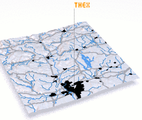 Places with similar names to The X, United States - USA ::
Disclaimer :: Information on this page comes without warranty of any kind |
||
|
Where is The X? Elevation and coordinates ::
Latitude (lat): 42°5'10"N Longitude (lon): 72°33'30"W
Elevation (approx.): 57m (map arrows pan, magnifying glasses zoom) |
||
|
Visiting The X? Hotel/Accommodation ::
Book a hotel in The X Travel Guide ::
rental cars ::
car rental offers GPS waypoint ::
download a GPX waypoint (PoI) of The X for your GPS receiver
|
||