|
search place name
|
||
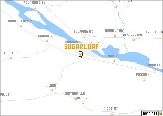
Sugarloaf (Minnesota, United States - USA)Sugarloaf is a town in the Minnesota region of United States - USA. An overview map of the region around Sugarloaf is displayed below.
regional and 3d topo map of Sugarloaf, United States - USA ::
Sugarloaf airports ::
The nearest airport is MSP - Minneapolis St Paul Intl, located 158.8 km north west of Sugarloaf.
Nearby towns ::
Winona (2.9km north west) //
East Winona (3.2km north east) //
Bluff Siding (5.0km north) //
Homer (5.4km east) //
Goodview (7.0km north west) //
Marshland (7.6km north east) //
Wilson (8.9km south west) //
[all distances 'as the bird flies' and approximate]  Places with similar names to Sugarloaf, United States - USA ::
// Sugarloaf (US)
// Sugarloaf (US)
// Sugarloaf (US)
// Sugar Loaf (US)
// Sugar Loaf (US)
// Sugar Loaf (US)
// Sugar Loaf (BS)
// Sugar Loaf (BS)
// Skrylovo (RU)
// Skärlöv (SE)
Disclaimer :: Information on this page comes without warranty of any kind |
||
|
Where is Sugarloaf? Elevation and coordinates ::
Latitude (lat): 44°1'36"N Longitude (lon): 91°37'23"W
Elevation (approx.): 211m (map arrows pan, magnifying glasses zoom) |
||
|
Visiting Sugarloaf? Hotel/Accommodation ::
Book a hotel in Sugarloaf Travel Guide ::
rental cars ::
car rental offers GPS waypoint ::
download a GPX waypoint (PoI) of Sugarloaf for your GPS receiver
|
||