|
search place name
|
||
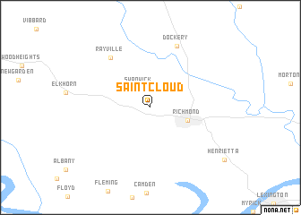
Saint Cloud (Missouri, United States - USA)Saint Cloud is a town in the Missouri region of United States - USA. An overview map of the region around Saint Cloud is displayed below.
regional and 3d topo map of Saint Cloud, United States - USA ::
Saint Cloud airports ::
The nearest airport is MCI - Kansas City Intl, located 60.0 km west of Saint Cloud.
Other airports nearby include SZL - Knobnoster Whiteman Afb (74.5 km south east), FLV - Fort Leavenworth Sherman Aaf (77.8 km west), FOE - Topeka Forbes Fld (147.3 km west), COU - Columbia Rgnl (164.3 km east), Nearby towns ::
 Places with similar names to Saint Cloud, United States - USA ::
// Saint Cloud (US)
// Saint Kilda (NZ)
// Saint Cloud (US)
// Saint Cloud (US)
// Saint Cloud (US)
// Saint-Claude (GP)
// Saint Cloud (HT)
// Saint-Claud (FR)
// Saint-Cloud (FR)
// Saint-Clet (FR)
Disclaimer :: Information on this page comes without warranty of any kind |
||
|
Where is Saint Cloud? Elevation and coordinates ::
Latitude (lat): 39°17'34"N Longitude (lon): 94°1'5"W
Elevation (approx.): 233m (map arrows pan, magnifying glasses zoom) |
||
|
Visiting Saint Cloud? Hotel/Accommodation ::
Book a hotel in Saint Cloud Travel Guide ::
rental cars ::
car rental offers GPS waypoint ::
download a GPX waypoint (PoI) of Saint Cloud for your GPS receiver
|
||