|
search place name
|
||
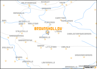
Browns Hollow (New York, United States - USA)Browns Hollow is a town in the New York region of United States - USA. An overview map of the region around Browns Hollow is displayed below.
regional and 3d topo map of Browns Hollow, United States - USA ::
Browns Hollow airports ::
The nearest airport is ALB - Albany Intl, located 58.1 km east of Browns Hollow.
Other airports nearby include SYR - Syracuse Hancock Intl (134.8 km west), SWF - Newburgh Stewart Intl (148.5 km south), GTB - Fort Drum Wheeler Sack Aaf (169.9 km north west), CEF - Chicopee Falls Westover Arb Metropolitan (175.9 km east), Nearby towns ::
Argusville (2.1km south west) //
Root Center (3.1km north east) //
Lykers (2.9km east) //
Flat Creek (3.9km north) //
Gilbert Corners (4.5km south west) //
Little York (5.7km south) //
Sharon (5.6km south) //
Mapletown (5.5km north west) //
Currytown (6.6km north east) //
Rural Grove (7.0km north east) //
Carlisle (7.5km south east) //
Sharon Center (7.2km south west) //
[all distances 'as the bird flies' and approximate]  Places with similar names to Browns Hollow, United States - USA ::
// Burunchel (ES)
// Bruyns Hill (ZA)
// Burnshill (ZA)
// Burnshill (ZA)
// Barnes Hole (US)
// Branch Hill (US)
// Browns Hill (US)
// Biron Shāl (PK)
// Browns Hall (JM)
// Barnes Hill (AG)
Disclaimer :: Information on this page comes without warranty of any kind |
||
|
Where is Browns Hollow? Elevation and coordinates ::
Latitude (lat): 42°48'27"N Longitude (lon): 74°30'26"W
Elevation (approx.): 300m (map arrows pan, magnifying glasses zoom) |
||
|
Visiting Browns Hollow? Hotel/Accommodation ::
Book a hotel in Browns Hollow Travel Guide ::
rental cars ::
car rental offers GPS waypoint ::
download a GPX waypoint (PoI) of Browns Hollow for your GPS receiver
|
||