|
search place name
|
||
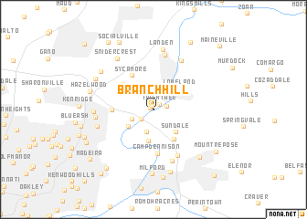
Branch Hill (Ohio, United States - USA)Branch Hill is a town in the Ohio region of United States - USA. An overview map of the region around Branch Hill is displayed below.
regional and 3d topo map of Branch Hill, United States - USA ::
Branch Hill airports ::
The nearest airport is LUK - Cincinnati Muni Lunken Fld, located 19.2 km south west of Branch Hill.
Other airports nearby include CVG - Cincinnati Northern Kentucky Intl (39.1 km south west), FFO - Dayton Wright Patterson Afb (67.8 km north), DAY - James M Cox Dayton Intl (73.1 km north), LCK - Columbus Rickenbacker Intl (133.2 km north east), Nearby towns ::
Symmes (0.3km west) //
The Village of Indian Hill (0.5km north west) //
Twightwee (0.9km north east) //
Epworth Heights (1.3km east) //
Miami Grove (1.7km south west) //
Indianview (2.8km south) //
Foxhunter Lane (2.3km south west) //
Remington (3.1km south west) //
Miamiville (3.8km south) //
Sundale (3.6km south east) //
Loveland (3.6km north east) //
The Highlands (4.2km south east) //
Sixteen Mile Stand (4.2km north west) //
Sycamore (4.6km north west) //
Jones Farm (4.0km west) //
Camp Dennison (5.4km south) //
Top-of-the-Ridge (6.0km south) //
Beverly Hills (6.4km south) //
Loveland Park (6.5km north east) //
Twenty Mile Stand (6.8km north) //
Montgomery (5.6km west) //
Montgomery Heights (5.6km west) //
Fairwind Acres (5.6km west) //
Landen (7.4km north) //
Snidercrest (7.1km north west) //
Indian Knolls (7.7km south) //
Milford (7.9km south) //
Highpoint (6.8km north west) //
Brecon (6.7km north west) //
[all distances 'as the bird flies' and approximate] 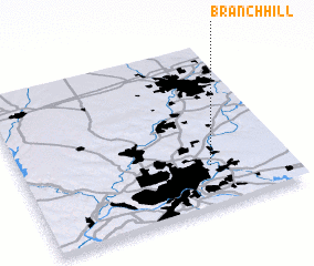 Places with similar names to Branch Hill, United States - USA ::
// Burunchel (ES)
// Bruyns Hill (ZA)
// Burnshill (ZA)
// Burnshill (ZA)
// Barnes Hole (US)
// Browns Hollow (US)
// Browns Hill (US)
// Biron Shāl (PK)
// Browns Hall (JM)
// Barnes Hill (AG)
Disclaimer :: Information on this page comes without warranty of any kind |
||
|
Where is Branch Hill? Elevation and coordinates ::
Latitude (lat): 39°14'46"N Longitude (lon): 84°17'36"W
Elevation (approx.): 179m (map arrows pan, magnifying glasses zoom) |
||
|
Visiting Branch Hill? Hotel/Accommodation ::
Book a hotel in Branch Hill Travel Guide ::
rental cars ::
car rental offers GPS waypoint ::
download a GPX waypoint (PoI) of Branch Hill for your GPS receiver
|
||