|
search place name
|
||
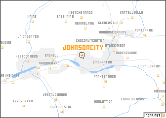
Johnson City (New York, United States - USA)Johnson City is a town in the New York region of United States - USA. An overview map of the region around Johnson City is displayed below.
regional and 3d topo map of Johnson City, United States - USA ::
Johnson City airports ::
The nearest airport is SYR - Syracuse Hancock Intl, located 111.3 km north of Johnson City.
Other airports nearby include IPT - Williamsport Rgnl (125.8 km south west), SWF - Newburgh Stewart Intl (168.4 km south east), ROC - Greater Rochester Intl (179.4 km north west), MUI - Muir Aaf (193.5 km south), Nearby towns ::
Westover (1.4km west) //
Choconut Center (3.3km north east) //
Willow Point (3.0km south west) //
Binghamton (3.9km south east) //
Endwell (5.1km west) //
New Ireland (7.0km north) //
Park Terrace (6.3km south east) //
Port Dickinson (5.5km east) //
Twin Orchard (5.9km west) //
Summit Hill (7.2km south east) //
Hinmans Corners (7.1km north east) //
Glen Castle (8.3km north east) //
East Maine (8.9km north) //
Newmans Corner (10.5km north east) //
[all distances 'as the bird flies' and approximate] 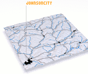 Places with similar names to Johnson City, United States - USA ::
// Johnson City (US)
// Johnson City (US)
// Johnson City (US)
// Johnson City (US)
// Johnson City (US)
Disclaimer :: Information on this page comes without warranty of any kind |
||
|
Where is Johnson City? Elevation and coordinates ::
Latitude (lat): 42°6'56"N Longitude (lon): 75°57'33"W
Elevation (approx.): 267m (map arrows pan, magnifying glasses zoom) |
||
|
Visiting Johnson City? Hotel/Accommodation ::
Book a hotel in Johnson City Travel Guide ::
rental cars ::
car rental offers GPS waypoint ::
download a GPX waypoint (PoI) of Johnson City for your GPS receiver
|
||