|
search place name
|
||
Bon Air (North Carolina, United States - USA)Bon Air is a town in the North Carolina region of United States - USA. An overview map of the region around Bon Air is displayed below.
regional and 3d topo map of Bon Air, United States - USA ::

Bon Air airports ::
The nearest airport is INT - Winston-salem Smith Reynolds, located 1.9 km east of Bon Air.
Other airports nearby include HKY - Hickory Rgnl (112.1 km west), CLT - Charlotte Douglas Intl (119.7 km south west), RDU - Raleigh-durham Raleigh Durham Intl (134.1 km east), POB - Fayetteville Pope Afb (153.8 km south east), Nearby towns ::
North Winston (1.2km south east) //
Brookwood (1.1km east) //
Montview (1.4km north) //
Forest Hills (1.9km north) //
Alspaugh (2.2km north west) //
Ogburn Station (2.8km north east) //
Winston-Salem (3.2km south) //
East Winston (3.3km south) //
Park Terrace (3.2km east) //
Columbia Heights (4.4km south) //
Oak Crest (3.8km west) //
Skyview Park (4.2km south east) //
West Highlands (4.3km south west) //
Reynolda (3.9km west) //
Buena Vista (4.1km south west) //
Salem (5.0km south) //
Reynolda Park (4.1km west) //
Cityview (4.5km south east) //
West Salem (5.1km south) //
Ardmore (5.6km south west) //
Creekwood Acres (5.6km north east) //
South Side (6.3km south) //
Oldtown (5.4km north west) //
Arcadia (6.4km south) //
Westview (5.5km south west) //
Shalimar (5.8km south east) //
Sunnyside (6.9km south) //
Bethania Station (6.3km north west) //
Day Acres (6.7km north east) //
[all distances 'as the bird flies' and approximate] 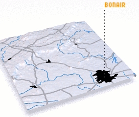 Places with similar names to Bon Air, United States - USA ::
Disclaimer :: Information on this page comes without warranty of any kind |
||
|
Where is Bon Air? Elevation and coordinates ::
Latitude (lat): 36°7'42"N Longitude (lon): 80°14'32"W
Elevation (approx.): 303m (map arrows pan, magnifying glasses zoom) |
||
|
Visiting Bon Air? Hotel/Accommodation ::
Book a hotel in Bon Air Travel Guide ::
rental cars ::
car rental offers GPS waypoint ::
download a GPX waypoint (PoI) of Bon Air for your GPS receiver
|
||