|
search place name
|
||
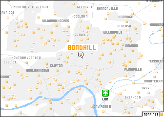
Bond Hill (Ohio, United States - USA)Bond Hill is a town in the Ohio region of United States - USA. An overview map of the region around Bond Hill is displayed below.
regional and 3d topo map of Bond Hill, United States - USA ::
Bond Hill airports ::
The nearest airport is LUK - Cincinnati Muni Lunken Fld, located 9.0 km south east of Bond Hill.
Other airports nearby include CVG - Cincinnati Northern Kentucky Intl (22.3 km south west), FFO - Dayton Wright Patterson Afb (80.8 km north east), DAY - James M Cox Dayton Intl (83.6 km north), LOU - Louisville Bowman Fld (147.9 km south west), Nearby towns ::
Cincinnati (1.7km south east) //
Norwood (2.2km south) //
Roselawn (2.3km north) //
Golf Manor (2.3km north east) //
Elmwood Place (2.3km north west) //
Carthage (2.7km north west) //
Edgemont (2.9km north) //
Idlewood (3.0km south) //
Ivorydale (2.5km west) //
Evanston (3.4km south) //
Idlewild (3.3km south) //
Saint Bernard (2.8km west) //
Norwood Heights (3.0km east) //
Ivorydale Junction (3.2km west) //
Valleydale (4.0km north) //
Brookwood (3.7km north east) //
Hartwell (4.3km north) //
Avondale (3.8km south west) //
Dallmans Corner (3.5km east) //
Oakley Square (3.9km south east) //
Arlington Heights (4.6km north) //
O'Bryonsville (4.8km south) //
Pleasant Ridge (3.8km east) //
Winton Terrace (3.9km west) //
Woodburn (5.1km south) //
Hyde Park (4.6km south east) //
Oakley (4.3km south east) //
Brookhill (4.8km north west) //
Winton Place (4.2km west) //
[all distances 'as the bird flies' and approximate]  Places with similar names to Bond Hill, United States - USA ::
// Bandahala (PH)
// Band-e Helī (IR)
// Bāndhuli (BD)
// Bāniādhala (BD)
// Bandahalli (IN)
// Bounty Hall (GY)
// Bounty Hall (JM)
Disclaimer :: Information on this page comes without warranty of any kind |
||
|
Where is Bond Hill? Elevation and coordinates ::
Latitude (lat): 39°10'29"N Longitude (lon): 84°28'2"W
Elevation (approx.): 186m (map arrows pan, magnifying glasses zoom) |
||
|
Visiting Bond Hill? Hotel/Accommodation ::
Book a hotel in Bond Hill Travel Guide ::
rental cars ::
car rental offers GPS waypoint ::
download a GPX waypoint (PoI) of Bond Hill for your GPS receiver
|
||