|
search place name
|
||
Ivorydale Junction (Ohio, United States - USA)Ivorydale Junction is a town in the Ohio region of United States - USA. An overview map of the region around Ivorydale Junction is displayed below.
regional and 3d topo map of Ivorydale Junction, United States - USA ::

Ivorydale Junction airports ::
The nearest airport is LUK - Cincinnati Muni Lunken Fld, located 10.5 km south east of Ivorydale Junction.
Other airports nearby include CVG - Cincinnati Northern Kentucky Intl (19.5 km south west), FFO - Dayton Wright Patterson Afb (82.7 km north east), DAY - James M Cox Dayton Intl (84.9 km north), LOU - Louisville Bowman Fld (145.3 km south west), Nearby towns ::
Saint Bernard (0.6km south east) //
Ivorydale (1.1km north east) //
Winton Place (1.1km north west) //
Winton Terrace (1.5km north west) //
Elmwood Place (2.4km north east) //
Avondale (2.6km south) //
Clifton (2.5km south west) //
Finneytown (3.7km north west) //
Idlewild (3.5km south east) //
Cumminsville (3.2km west) //
Carthage (3.7km north east) //
Idlewood (3.5km south east) //
Knowltons Corner (3.3km south west) //
Bond Hill (3.2km east) //
Greenfield Village (4.1km north west) //
Clifton Heights (4.2km south west) //
Losantville Triangle (4.6km south) //
Brookhill (4.6km north) //
Evanston (4.1km south east) //
Valleydale (4.6km north east) //
Rohs Hill (4.7km south) //
Wintondale (5.0km north) //
Peebles Corner (5.1km south) //
North Hills Estates (5.0km north) //
Norwood (4.2km south east) //
Camp Washington (4.7km south west) //
Walnut Hills (5.1km south) //
Cincinnati (4.2km east) //
Corryville (5.2km south) //
[all distances 'as the bird flies' and approximate] 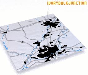 Places with similar names to Ivorydale Junction, United States - USA :: Disclaimer :: Information on this page comes without warranty of any kind |
||
|
Where is Ivorydale Junction? Elevation and coordinates ::
Latitude (lat): 39°10'12"N Longitude (lon): 84°30'15"W
Elevation (approx.): 153m (map arrows pan, magnifying glasses zoom) |
||
|
Visiting Ivorydale Junction? Hotel/Accommodation ::
Book a hotel in Ivorydale Junction Travel Guide ::
rental cars ::
car rental offers GPS waypoint ::
download a GPX waypoint (PoI) of Ivorydale Junction for your GPS receiver
|
||