|
search place name
|
||
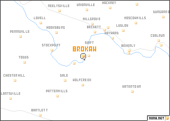
Brokaw (Ohio, United States - USA)Brokaw is a town in the Ohio region of United States - USA. An overview map of the region around Brokaw is displayed below.
regional and 3d topo map of Brokaw, United States - USA ::
Brokaw airports ::
The nearest airport is LCK - Columbus Rickenbacker Intl, located 107.8 km west of Brokaw.
Other airports nearby include CMH - Port Columbus Intl (112.6 km north west), PIT - Pittsburgh (pennsylva) Pittsburgh Intl (166.5 km north east), AKR - Akron Fulton Intl (169.1 km north), EKN - Elkins Randolph Co Jennings Randolph (176.4 km south east), Nearby towns ::
Luke Chute (1.3km north east) //
Roxbury (1.9km west) //
Swift (3.0km north) //
Wolf Creek (5.4km south) //
Dale (5.5km south west) //
Beckett (6.5km north) //
Stockport (6.1km west) //
Hayward (6.8km north east) //
Relief (7.5km north east) //
Mill Grove (8.2km north) //
Hooksburg (7.9km north west) //
Center Bend (8.3km north east) //
Patten Mills (9.2km south west) //
Ludlow (9.3km north east) //
[all distances 'as the bird flies' and approximate] 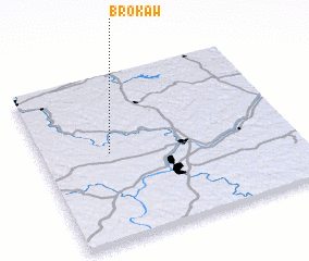 Places with similar names to Brokaw, United States - USA ::
Disclaimer :: Information on this page comes without warranty of any kind |
||
|
Where is Brokaw? Elevation and coordinates ::
Latitude (lat): 39°31'41"N Longitude (lon): 81°43'38"W
Elevation (approx.): 208m (map arrows pan, magnifying glasses zoom) |
||
|
Visiting Brokaw? Hotel/Accommodation ::
Book a hotel in Brokaw Travel Guide ::
rental cars ::
car rental offers GPS waypoint ::
download a GPX waypoint (PoI) of Brokaw for your GPS receiver
|
||