|
search place name
|
||
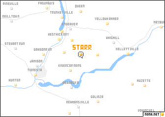
Starr (Pennsylvania, United States - USA)Starr is a town in the Pennsylvania region of United States - USA. An overview map of the region around Starr is displayed below.
regional and 3d topo map of Starr, United States - USA ::
Starr airports ::
The nearest airport is YNG - Youngstown Warren Rgnl, located 114.2 km west of Starr.
Other airports nearby include PIT - Pittsburgh (pennsylva) Pittsburgh Intl (136.6 km south west), AOO - Altoona Blair Co (162.5 km south east), BUF - Buffalo Niagara Intl (165.2 km north), IAG - Niagara Falls Intl (178.7 km north), Nearby towns ::
Crystal Springs (2.7km east) //
Kiser Corners (3.4km south west) //
Little Hickory (3.4km north west) //
Church Hill (4.6km north west) //
West Hickory (6.0km north west) //
Nebraska (6.9km south) //
Endeavor (7.1km north) //
East Hickory (7.0km north west) //
Whig Hill (6.4km north east) //
Dawson Run (6.7km west) //
Yellow Hammer (9.0km north east) //
[all distances 'as the bird flies' and approximate] 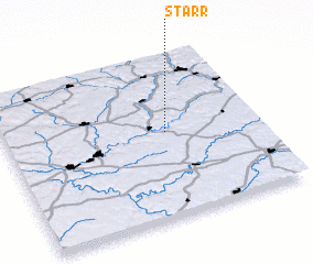 Places with similar names to Starr, United States - USA ::
Disclaimer :: Information on this page comes without warranty of any kind |
||
|
Where is Starr? Elevation and coordinates ::
Latitude (lat): 41°31'43"N Longitude (lon): 79°21'38"W
Elevation (approx.): 531m (map arrows pan, magnifying glasses zoom) |
||
|
Visiting Starr? Hotel/Accommodation ::
Book a hotel in Starr Travel Guide ::
rental cars ::
car rental offers GPS waypoint ::
download a GPX waypoint (PoI) of Starr for your GPS receiver
|
||