|
search place name
|
||
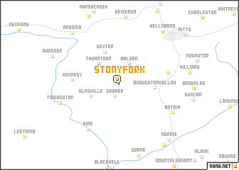
Stony Fork (Pennsylvania, United States - USA)Stony Fork is a town in the Pennsylvania region of United States - USA. An overview map of the region around Stony Fork is displayed below.
regional and 3d topo map of Stony Fork, United States - USA ::
Stony Fork airports ::
The nearest airport is IPT - Williamsport Rgnl, located 60.4 km south east of Stony Fork.
Other airports nearby include MUI - Muir Aaf (152.8 km south east), ROC - Greater Rochester Intl (162.6 km north), MDT - Harrisburg Intl (171.9 km south), AOO - Altoona Blair Co (172.8 km south west), Nearby towns ::
Draper (1.9km south) //
Balsam (3.5km north) //
Thumptown (4.1km north west) //
Olmsville (3.8km south west) //
Broughton Hollow (4.2km east) //
Dexter (5.5km north) //
Kennedy (5.5km west) //
Coolidge Hollow (6.1km east) //
Pine (7.9km south west) //
Antrim (7.6km south east) //
Wellsboro (9.8km north east) //
Ansonia (9.8km north west) //
Morris (10.4km south east) //
[all distances 'as the bird flies' and approximate]  Places with similar names to Stony Fork, United States - USA ::
Disclaimer :: Information on this page comes without warranty of any kind |
||
|
Where is Stony Fork? Elevation and coordinates ::
Latitude (lat): 41°40'23"N Longitude (lon): 77°21'45"W
Elevation (approx.): 428m (map arrows pan, magnifying glasses zoom) |
||
|
Visiting Stony Fork? Hotel/Accommodation ::
Book a hotel in Stony Fork Travel Guide ::
rental cars ::
car rental offers GPS waypoint ::
download a GPX waypoint (PoI) of Stony Fork for your GPS receiver
|
||